


Montana® 700i
Rugged GPS Touchscreen Navigator with inReach® Technology
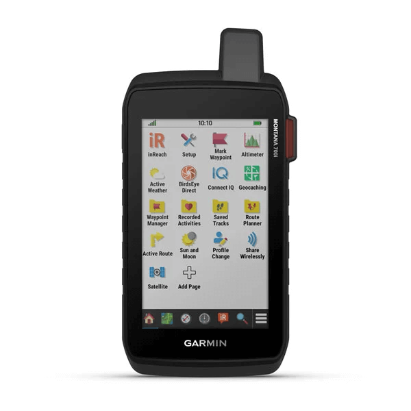
inReach® Technology
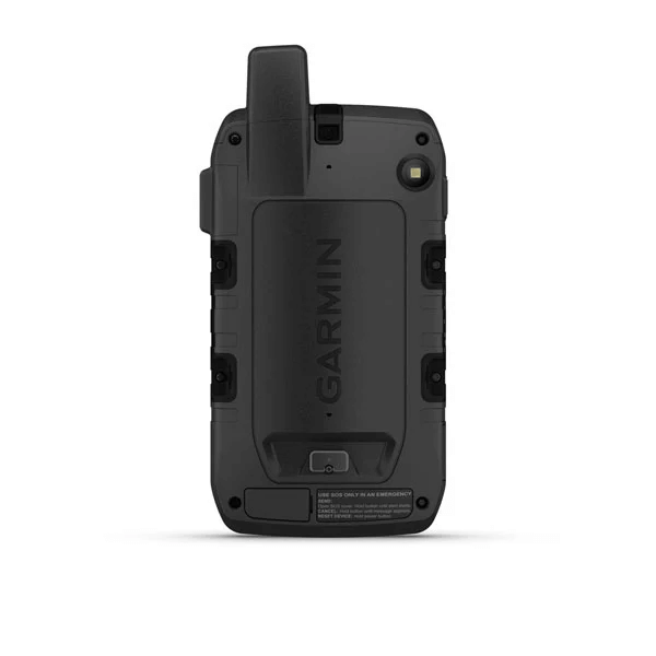
8 MP Camera

GO INTO THE WILD WITH A SATELLITE CONNECTION
To keep adventurers in touch and on track, the Montana 700i handheld combines the flexibility of on- or off-road navigation with global messaging and interactive SOS via inReach satellite technology1.
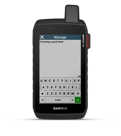
Big news. A full QWERTY keyboard lets you easily type messages. | Wander wider and still stay in touch — with inReach for messaging and 24/7 SOS. | Routable TopoActive Europe maps. Now you’re free to take it off-road or on. |
Meets MIL-STD 810 for thermal, shock, water and vibration. | Get the clear perspective of BirdsEye Satellite Imagery right to your device. | Power your adventures with 18+ hours of lithium-ion battery life in GPS mode. |

Link up from
way out — with
inReach
technology.
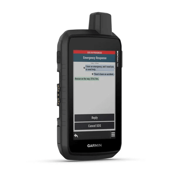
TWO-WAY MESSAGINGExchange text messages with loved ones, post to social media, or communicate via inReach device to inReach device in the field (active satellite subscription required). |
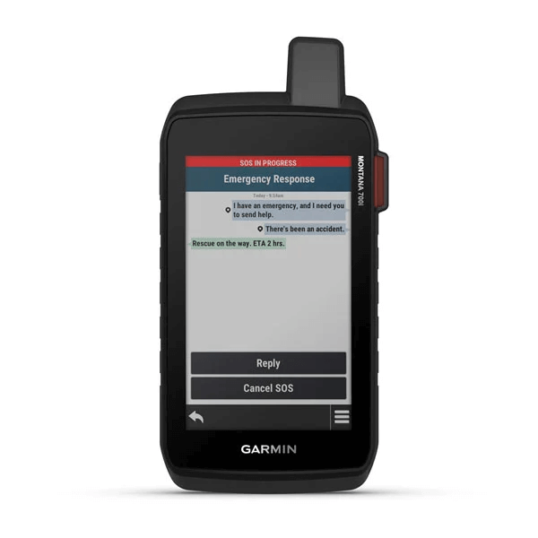
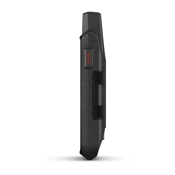
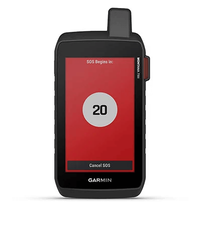
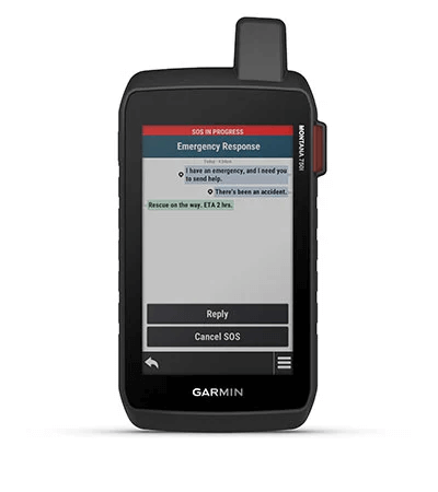
INTERACTIVE SOSIn case of emergency, trigger an interactive SOS message to GEOS, a professional 24/7 global monitoring and response centre (active satellite subscription required). |
GLOBAL CONNECTIVITYInstead of relying on cellphone coverage, now your messages, SOS and tracking are transferred via the 100% global Iridium® satellite network (active satellite subscription required). |
Be prepared. With
navigation for any
situation.
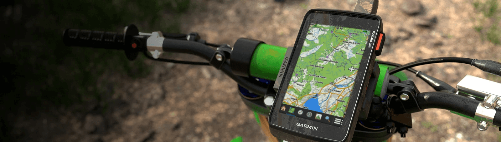
RUGGED BY DESIGNThis durable, water-resistant handheld is tested to U.S. military standards and features a glove-friendly 5” touchscreen that’s 50% larger than previous Montana models. |
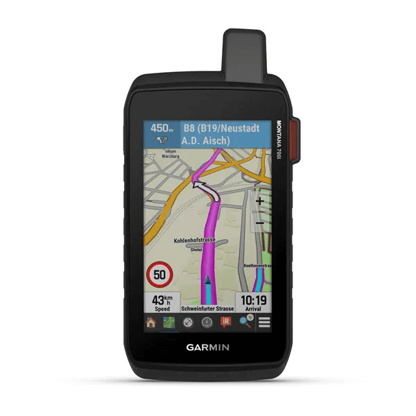
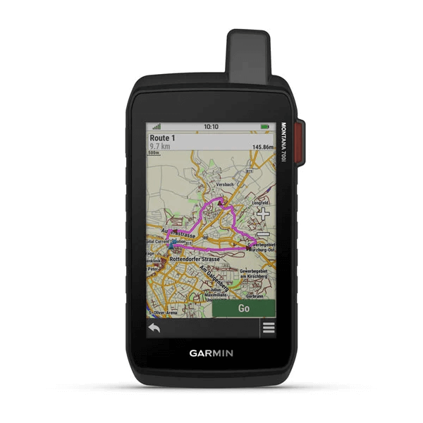
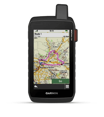
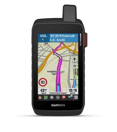
CITY NAVIGATOR MAPSSeamlessly transition from trails to road navigation with preloaded City Navigator street mapping, which guides your drive with easy-to-follow turn-by-turn directions. |
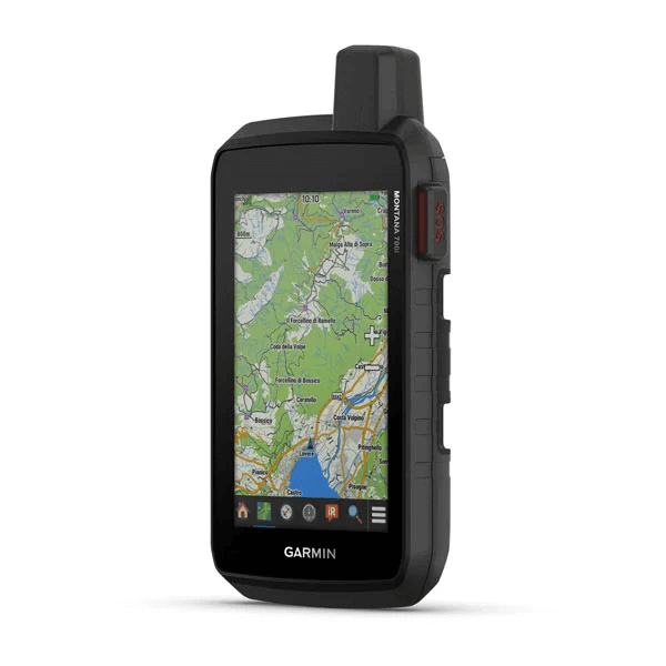
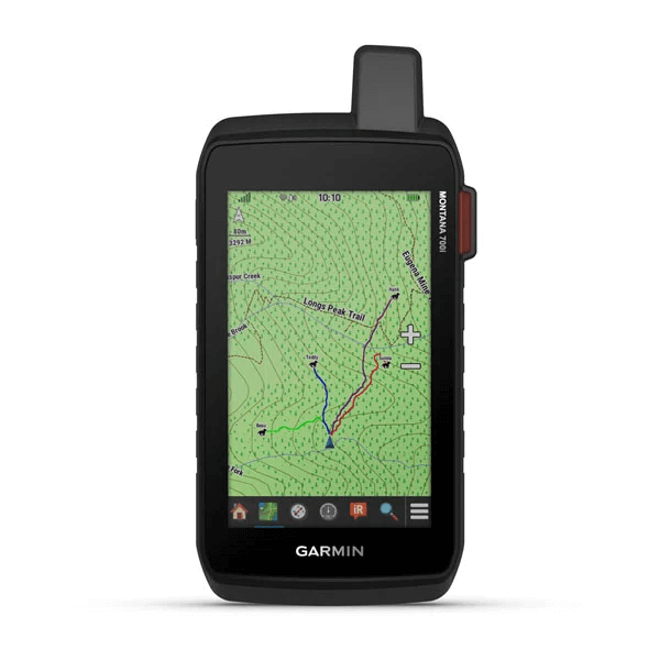
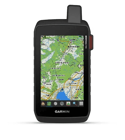
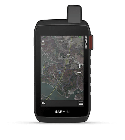
TOPOACTIVE EUROPE MAPSTo navigate your adventures, use preloaded TopoActive Europe maps. View elevations, coastlines, rivers, landmarks and more. |
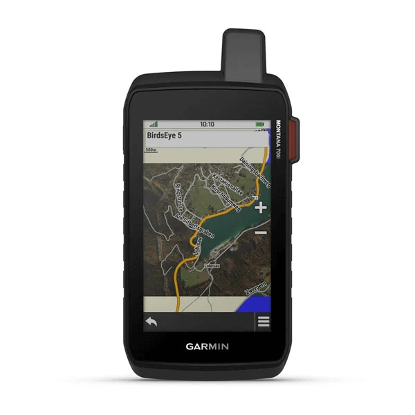
SATELLITE VIEWSUse direct-to-device downloads of BirdsEye Satellite Imagery (no annual subscription required) to see photo-realistic views and create waypoints based on landmarks. |
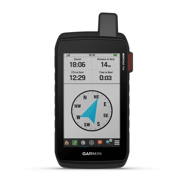
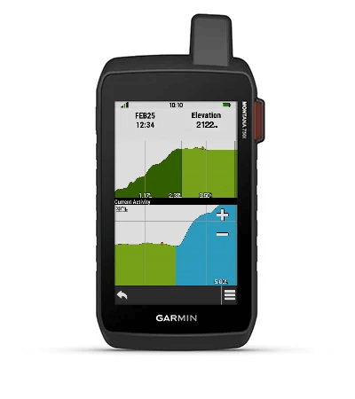
ABC SENSORSNavigate your next trail with ABC sensors, including an altimeter for elevation data, barometer to monitor weather and 3-axis electronic compass. |
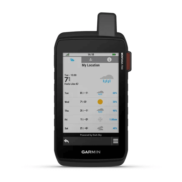
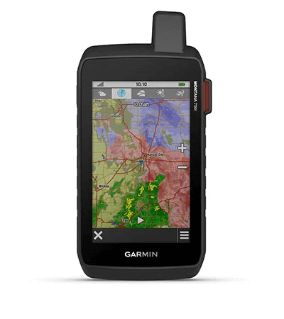
ACTIVE WEATHERUse cellular connectivity2 to access up-to-date Active Weather forecasts through the Garmin Connect™ app. |

Stay on track
while venturing
off-grid.
MULTI-GNSS SUPPORTAccess to GPS, GLONASS and GALILEO satellite networks enables Montana® 700i to track in more challenging environments than GPS alone. | TRACKINGTrack your location, and share it with those at home or out in the field. They´ll be able to see your progress or ping your device for your GPS location and more via your web-based MapShare™ trip-sharing page. (Montana 700i, 750i only - satellite subscription required). | EXPEDITION MODETrek far and wide off-grid. Use Expedition mode, an ultralow-power GPS reference, to keep Montana tracking for a week or more between recharges. |
General
| PHYSICAL DIMENSIONS | 9.19 x 18.30 x 3.27 cm |
| TOUCHSCREEN | |
| DISPLAY SIZE | 6.48 x 10.80 cm; 5" diag (12.70 cm) |
| DISPLAY RESOLUTION | 480 x 800 pixels |
| DISPLAY TYPE | WVGA transflective, dual orientation |
| WEIGHT | 410 g with included lithium-ion battery pack |
| BATTERY TYPE | rechargeable lithium-ion (included) |
| BATTERY LIFE | GPS Mode: up to 18 hours Expedition Mode: up to 330 hours GPS Mode, 10 min Tracking: up to 18 hours Expedition Mode, 30 min Tracking: up to 300 hours |
| WATER RATING | IPX7 |
| MIL-STD-810 | yes (thermal, shock, water, vibe) |
| HIGH-SENSITIVITY RECEIVER | |
| INTERFACE | High speed micro USB and NMEA 0183 compatible |
| MEMORY/HISTORY | 16 GB (user space varies based on included mapping) |
Maps & memory
| PRELOADED MAPS | Yes (TopoActive Europe) |
| ABILITY TO ADD MAPS | |
| BASEMAP | |
| AUTOMATIC ROUTING (TURN BY TURN ROUTING ON ROADS) | Yes (with optional mapping for detailed roads) |
| MAP SEGMENTS | 15000 |
| BIRDSEYE | Yes (direct to device) |
| INCLUDES DETAILED HYDROGRAPHIC FEATURES (COASTLINES, LAKE/RIVER SHORELINES, WETLANDS AND PERENNIAL AND SEASONAL STREAMS) | |
| INCLUDES SEARCHABLE POINTS OF INTERESTS (PARKS, CAMPGROUNDS, SCENIC LOOKOUTS AND PICNIC SITES) | |
| DISPLAYS NATIONAL, STATE AND LOCAL PARKS, FORESTS, AND WILDERNESS AREAS | |
| STORAGE AND POWER CAPACITY | Yes (32 GB max microSD™ card) |
| WAYPOINTS/FAVOURITES/LOCATIONS | 10000 |
| TRACKS | 250 |
| TRACK LOG | 20000 points, 250 saved gpx tracks, 300 saved fit activities |
| ROUTES | 250, 250 points per route; 50 points auto routing |
| RINEX LOGGING |
Sensors
| GPS | |
| GALILEO | |
| BAROMETRIC ALTIMETER | |
| COMPASS | Yes (tilt-compensated 3-axis) |
| GPS COMPASS (WHILE MOVING) |
Daily Smart Features
| CONNECT IQ™ (DOWNLOADABLE WATCH FACES, DATA FIELDS, WIDGETS AND APPS) | |
| SMART NOTIFICATIONS ON HANDHELD | |
| WEATHER | |
| VIRB® CAMERA REMOTE | |
| COMPATIBLE WITH GARMIN CONNECT™ MOBILE | |
| ACTIVE WEATHER |
Safety and Tracking Features
| LIVETRACK |
Outdoor recreation features
| POINT-TO-POINT NAVIGATION | |
| MOVCOMPATIBLE WITH BASECAMP™ | |
| AREA CALCULATION | |
| HUNT/FISH CALENDAR | |
| SUN AND MOON INFORMATION | |
| XERO™ LOCATIONS | |
| GEOCACHING-FRIENDLY | yes (Geocache Live) |
| CUSTOM MAPS COMPATIBLE | yes (500 custom map tiles) |
| PICTURE VIEWER | |
| LED BEACON FLASHLIGHT |
inReach® features
| INTERACTIVE SOS | |
| SEND AND RECEIVE TEXT MESSAGES TO SMS AND EMAIL | |
| SEND AND RECEIVE TEXT MESSAGES TO OTHER INREACH DEVICE | |
| EXCHANGE LOCATIONS WITH OTHER INREACH DEVICE | |
| MAPSHARE COMPATIBLE WITH TRACKING | |
| VIRTUAL KEYBOARD FOR CUSTOM MESSAGING |
Outdoor applications
| COMPATIBLE WITH GARMIN EXPLORE™ APP | |
| GARMIN EXPLORE WEBSITE COMPATIBLE | |
| DOG TRACKING | yes (when paired to compatible dog track system) |
Connections
| WIRELESS CONNECTIVITY | Yes (Wi-Fi®, Bluetooth®, ANT+®) |
- Montana® 700i
- Lithium-ion battery pack
- USB cable
- Documentation