


Overlander
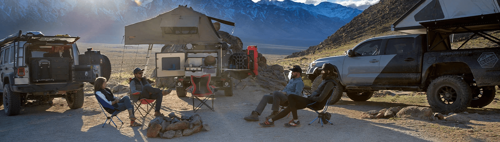
ROAM THE UNKNOWN
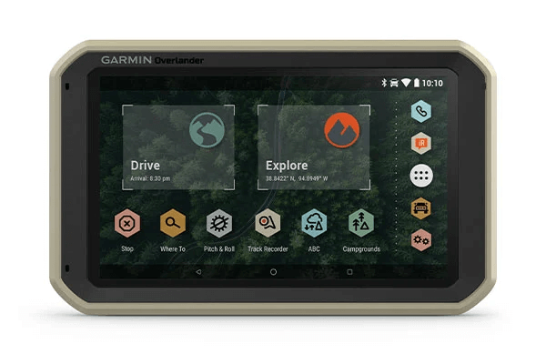
Built for every part of the journey, Overlander is the rugged, all-terrain navigator with on- and off-road navigation.
Get the lay of the land with topographic maps for Europe, Middle East and Africa | Or get spoken directions to the nearest coffee shop with street maps. | Share1 the plans for adventure through Garmin Explore. From your laptop to your phone to your friends. |
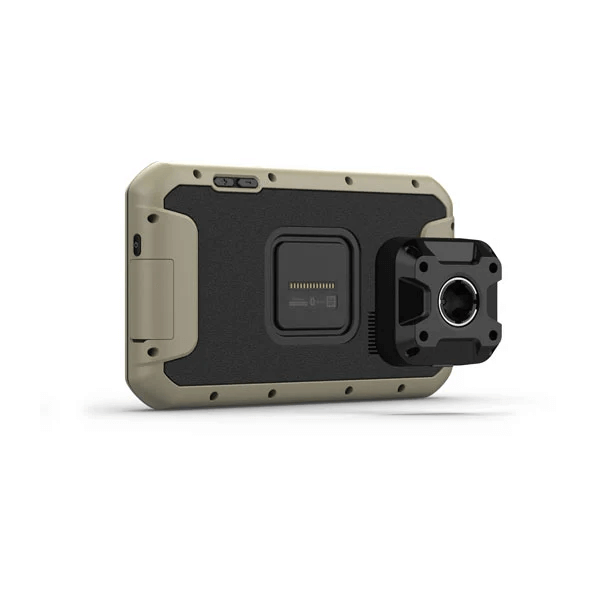
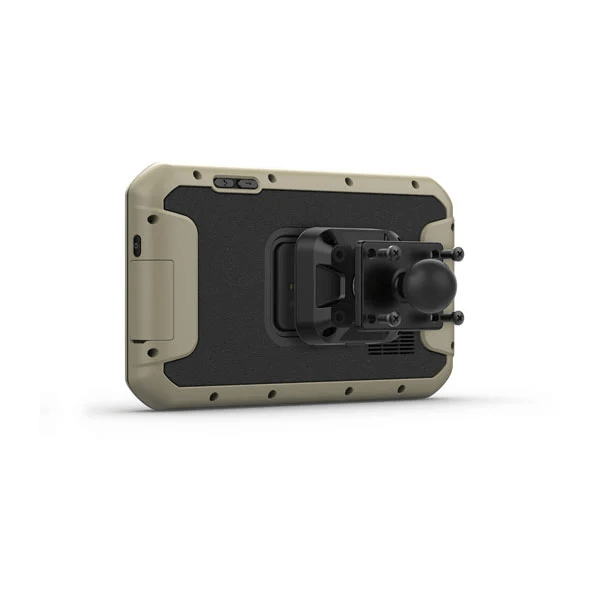
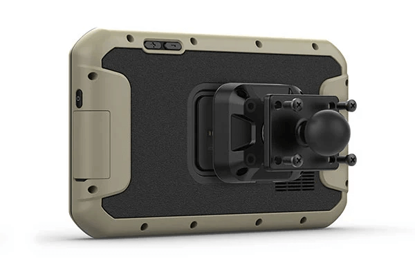
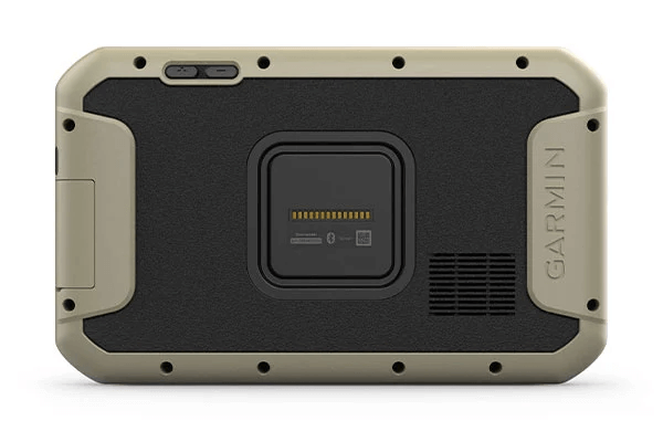
Comes with a powered magnetic mount and an adapter with AMPS plate compatible with RAM mounts. It’s not going anywhere. | Search for the nearest inspiration point while you’re in the middle of nowhere. | Need to bring your own satellite imagery? How does 64 GB of built-in storage sound? |

Built tough for the
journey ahead.
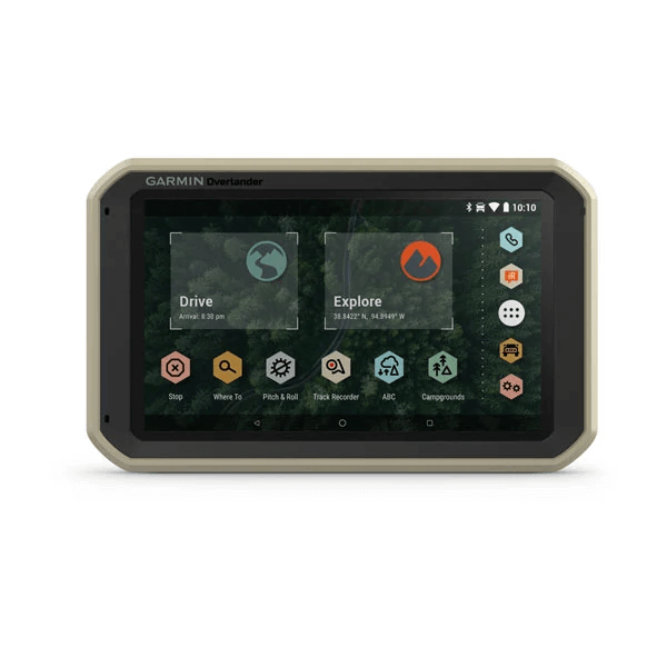
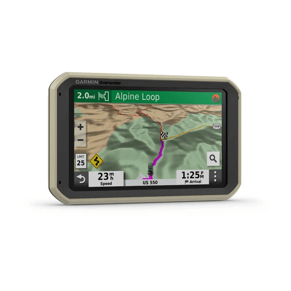
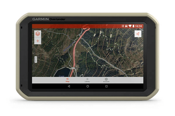
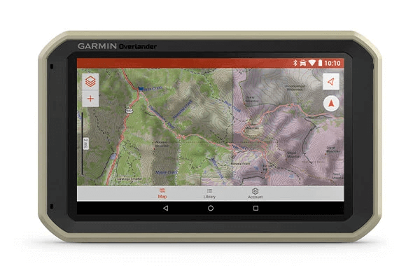
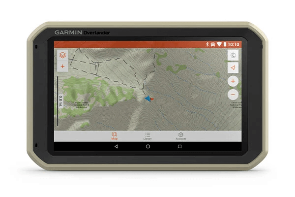
ON AND OFF ROAD7″ colour touchscreen features turn-by-turn directions for on-road navigation covering Europe, Middle East and Africa, and topography maps for off-road guidance. Includes 64GB internal memory to download additional TOPO maps. |
MILITARY STANDARD 810Overlander is built to the U.S. military standard 810 for thermal and shock resistance. It can be mounted anywhere, thanks to the powered magnetic mount that comes with suction cup and 1” ball adapter with AMPS plate compatible with RAM mounting systems. |
IP5X DUST RATINGThis essential piece of overlanding gear is purpose-built from the circuit board up and is designed to withstand dust and extreme temperatures. |
Go beyond the
road less
traveled.
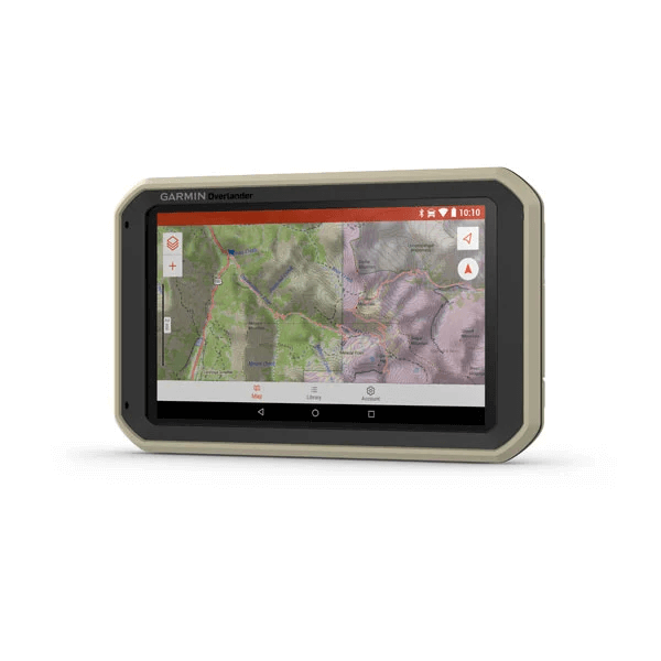
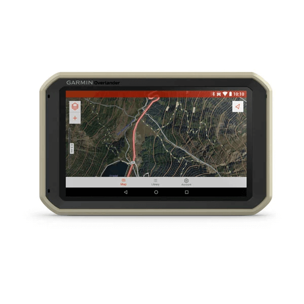
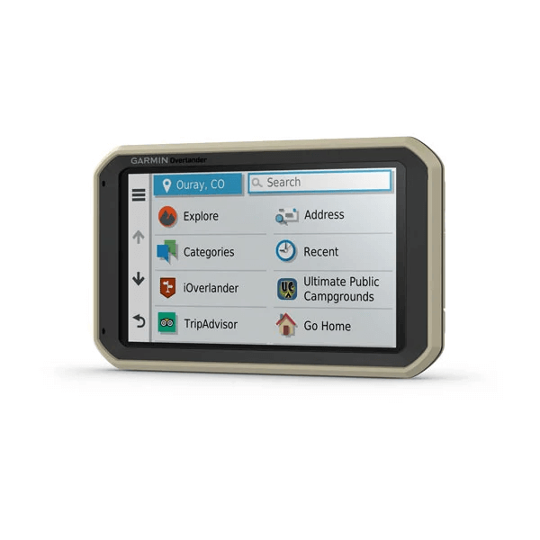
GARMIN EXPLOREUse the Garmin Explore app to download additional maps – such as satellite imagery and USGS quad sheets on 64 GB of internal storage – and sync all your data between devices. Easily import and export GPX files to Garmin Explore — even if offline. |
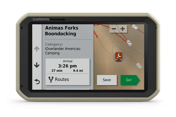
FIND CAMPSITESOverlander is preloaded with iOverlander POIs and Ultimate Public Campgrounds, so you don’t need a cell signal to route to the best-established, wild and dispersed campsites. |
FIND BOUNDARIESOverlander features topographic maps, including public land boundaries, 4x4 roads, forest service roads, waterways, trails and other land use data. |
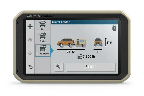
KNOW YOUR VEHICLECustomise street navigation for the size and weight of your overlanding vehicle, plus get alerts for upcoming bridge heights, weight limits, sharp curves, steep grades and more. |
MULTI-GNSS SUPPORTGPS, GLONASS and Galileo support helps track in more challenging environments than GPS alone. |
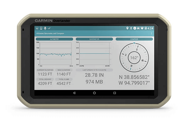
NAVIGATION TOOLSAll of your overlanding equipment – such as a built-in compass, altimeter and barometer – is now in one device. |

The right tools for
the roughest
roads.
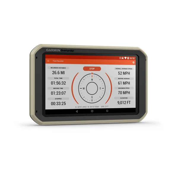
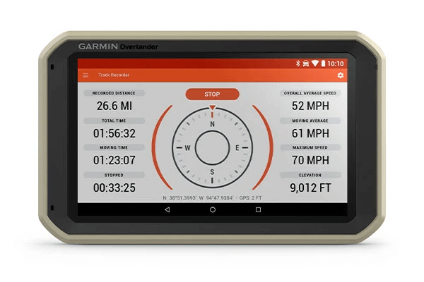
TRACK RECORDERRecord your tracks, and save them to your Garmin Explore account so you can review them later on any device or share them with friends. |
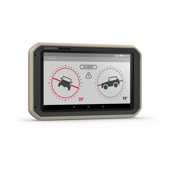
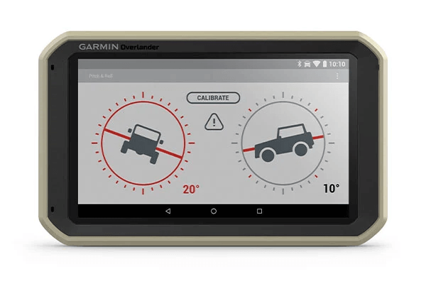
PITCH AND ROLLOverlander comes with integrated pitch and roll angles to help you and your vehicle navigate difficult terrain. |
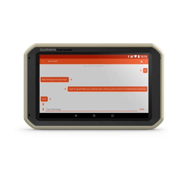
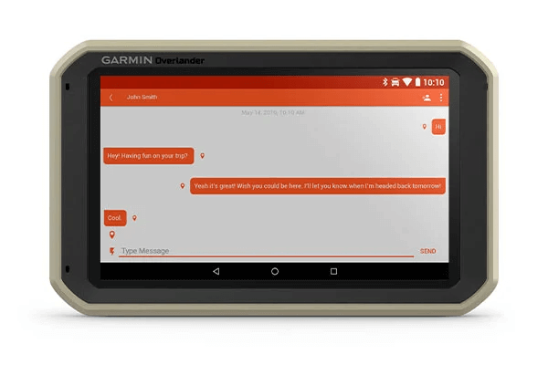
INREACH® COMPATIBLEPair your Overlander navigator with the inReach Explorer®+, inReach SE®+ and inReach® Mini satellite communicators2 (sold separately) for two-way text messaging, interactive SOS and weather forecasts. |
General
| PHYSICAL DIMENSIONS | W x H x D 19.9 x 12.2 x 2.4 cm |
| DISPLAY SIZE | W x H 15.2 x 8.9 cm; 7" diagonal |
| DISPLAY RESOLUTION | 1024 x 600 pixels |
| DISPLAY TYPE | Multi-touch, glass, WSVGA colour TFT with white backlight |
| WEIGHT | 437 g |
| BATTERY TYPE | Rechargeable lithium-ion |
| BATTERY LIFE | Up to 3 hours |
| DROP RATING | MIL-STD-810 |
| DUST RATING | IP5X |
| MAGNETIC MOUNT | |
| 1" BALL ADAPTER WITH AMPS PLATE |
Maps & memory
| PRELOADED STREET MAPS | |
| DATA CARDS | MicroSD™ card (not included) |
| 3D TERRAIN | |
| INTERNAL STORAGE | 64 GB |
| INCLUDES MAP UPDATES | |
| DOWNLOADABLE SATELLITE IMAGERY | Yes (U.S. only) |
Sensors
| GPS | |
| GLONASS | |
| GALILEO | |
| BAROMETRIC ALTIMETER | |
| COMPASS |
Outdoor recreation features
| PRELOADED TOPOACTIVE EUROPE MAPS |
Camera features
| BACKUP CAMERA COMPATIBLE | Yes (BC™ 35) |
Navigation features
| GARMIN REAL DIRECTIONS™ LANDMARK GUIDANCE | |
| MILLIONS OF FOURSQUARE® POINTS OF INTEREST | |
| TRIPADVISOR® TRAVELLER RATINGS | |
| ROUTE SHAPING THROUGH PREFERRED CITIES/STREETS | |
| VOICE-ACTIVATED NAVIGATION (OPERATE DEVICE WITH SPOKEN COMMANDS) FULL EUROPE VERSION ONLY | |
| TRAFFIC UPDATES | Yes (with DAB Digital Traffic) |
| LANE ASSIST WITH JUNCTION VIEW (DISPLAYS JUNCTION SIGNS) | |
| BLUETOOTH® CALLING | |
| SPEED LIMIT INDICATOR (DISPLAYS SPEED LIMIT FOR MOST MAJOR ROADS IN THE U.S. AND EUROPE) | |
| DRIVER ALERTS FOR SHARP CURVES, SCHOOL ZONES, RED LIGHT AND SPEED CAMERA WARNINGS AND MORE |
Advanced features
| WI-FI® MAP AND SOFTWARE UPDATES |
Camper Features
| SPECIALISED CAMPER ROUTING | |
| CAMPER SITES & SERVICES DIRECTORY | |
| ROAD ELEVATIONS | |
| SPEED LIMIT CHANGES | |
| COUNTRY BORDERS |
Adventure Features
| PAIR WITH COMPATIBLE INREACH® DEVICES | |
| TRACK RECORDER (BREADCRUMBS) | |
| IOVERLANDER™ POINTS OF INTEREST | |
| ACSI, CAMPERCONTACT AND TRAILER'S PARK | |
| PITCH AND ROLL GAUGES |
Outdoor applications
| COMPATIBLE WITH GARMIN EXPLORE™ APP |
- Overlander
- Vehicle suction cup mount
- RAM ball adapter with AMPS plate
- Traffic receiver/Vehicle power cable
- USB cable
- Documentation