
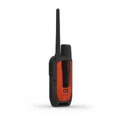


Alpha 300
Handheld Only
inReach® Technology
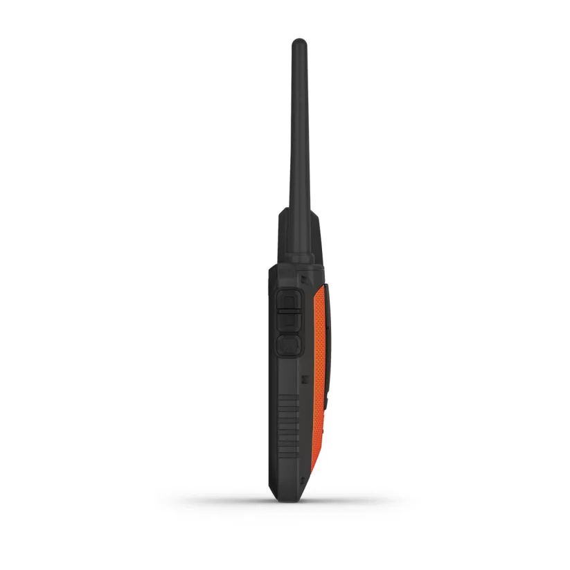
Alpha® 300/300i

STRONG CONNECTION. STRONG BOND.
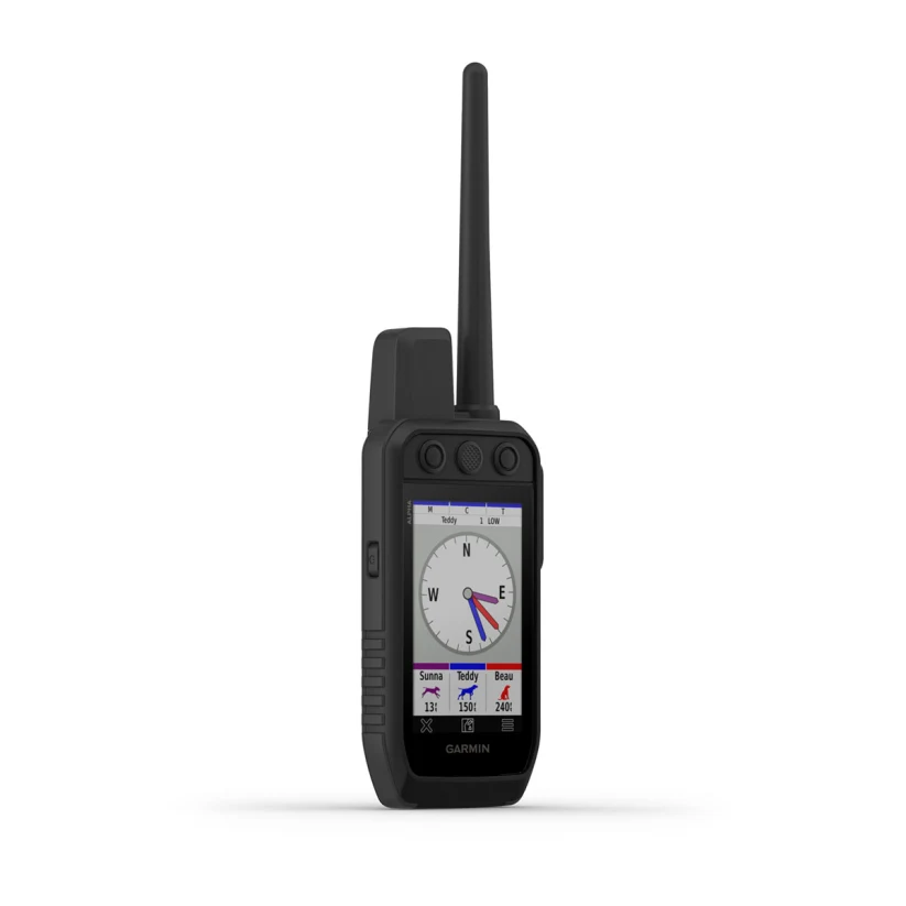
Sagebrush plateaus, rolling prairies, dense hardwoods, rocky ridges — no matter where you hunt, you and your dogs need reliable gear. Track and train your dogs in the field with the Alpha 300 handheld, featuring a new vivid 3.5” touchscreen and user-friendly 6-button design. Connected to Garmin dog tracking collars (sold separately).
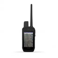
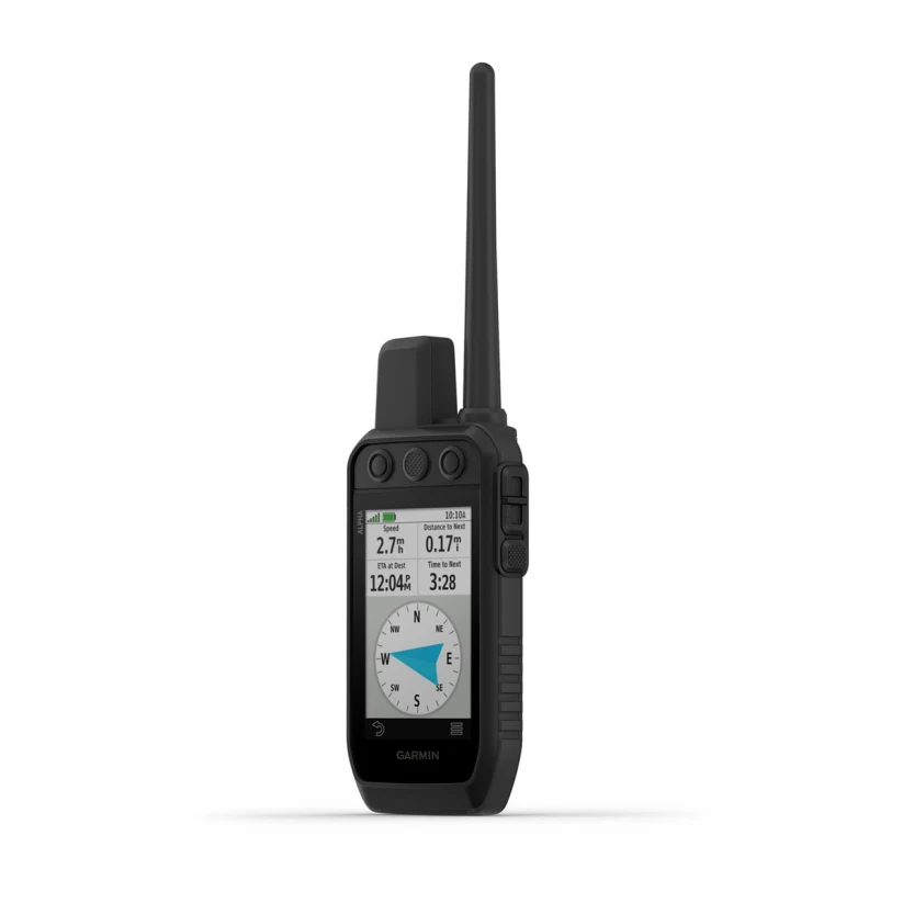
 INTERACT WITH A RESPONSIVE TOUCHSCREEN AND BUTTONS. | TRACK AND TRAIN YOUR PACK IN THE FIELD1. |  THE USER-REPLACEABLE BATTERY LASTS UP TO 55 HOURS. |
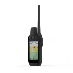
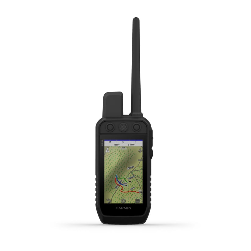
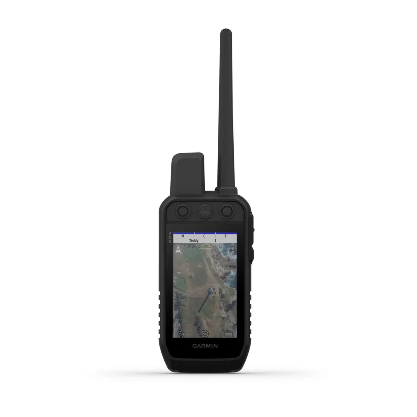
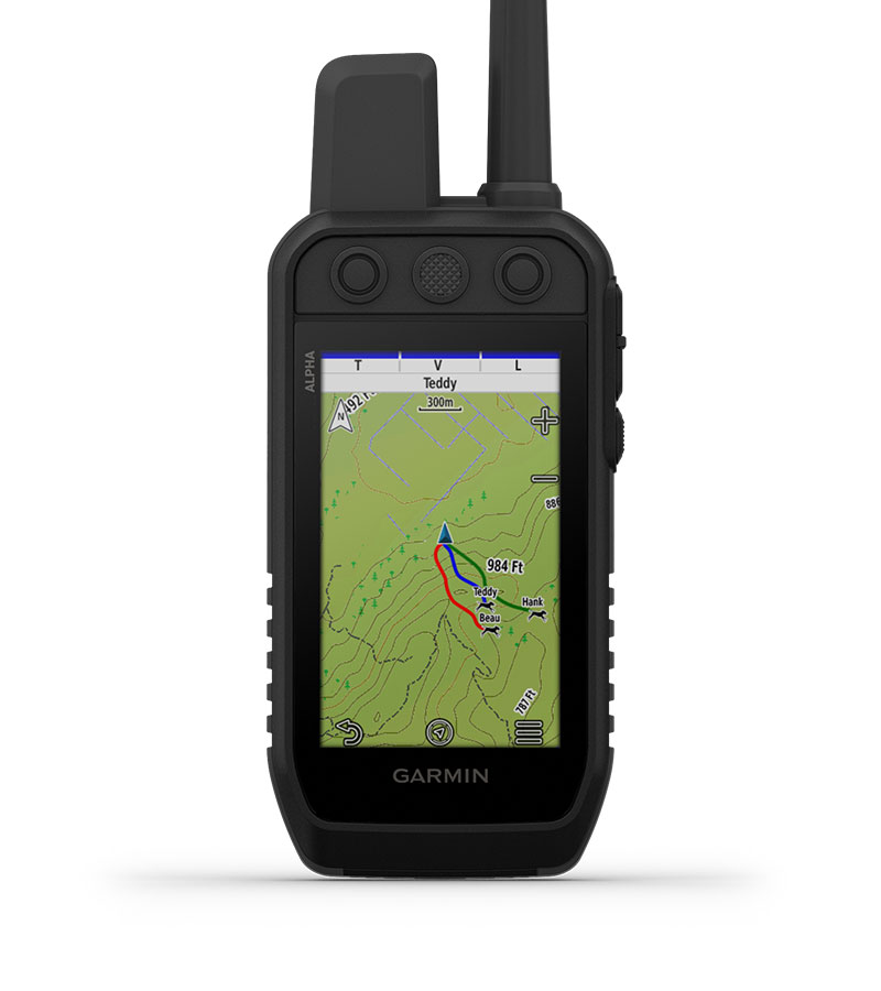
 NAVIGATE WITH TOPOACTIVE MAPS AND DOWNLOADABLE SATELLITE IMAGERY. |
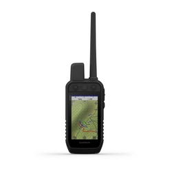
VIVID DISPLAY AND TOUCHSCREENSee your maps and track your dogs on an even brighter 3.5” display with up to a 2.5-second update rate. Easily interact with the device on a responsive touchscreen, even with gloves on, and read the screen in a variety of light conditions. |
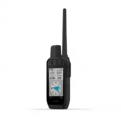
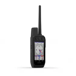
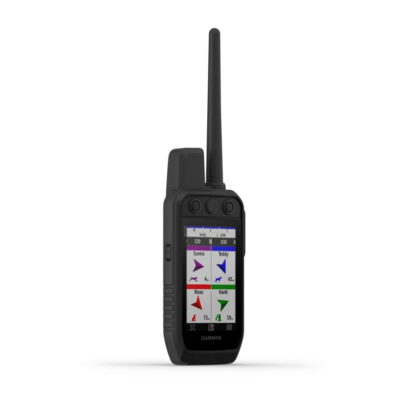
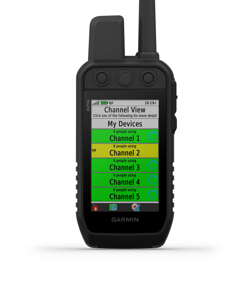
CHANNEL VIEWMonitor the concentration of collars in the area, and easily select less congested channels to avoid interference. |
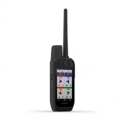
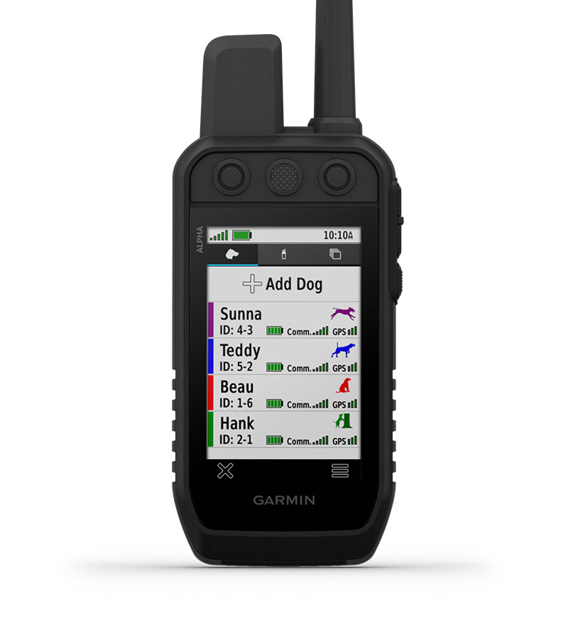
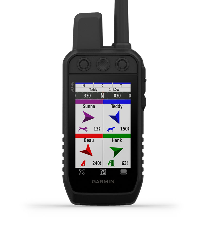
TRACK YOUR PACKMonitor up to 20 dogs with your compatible dog collars — from up to 9 miles away — on the color touchscreen display. Use Garmin Collars (sold separately). |
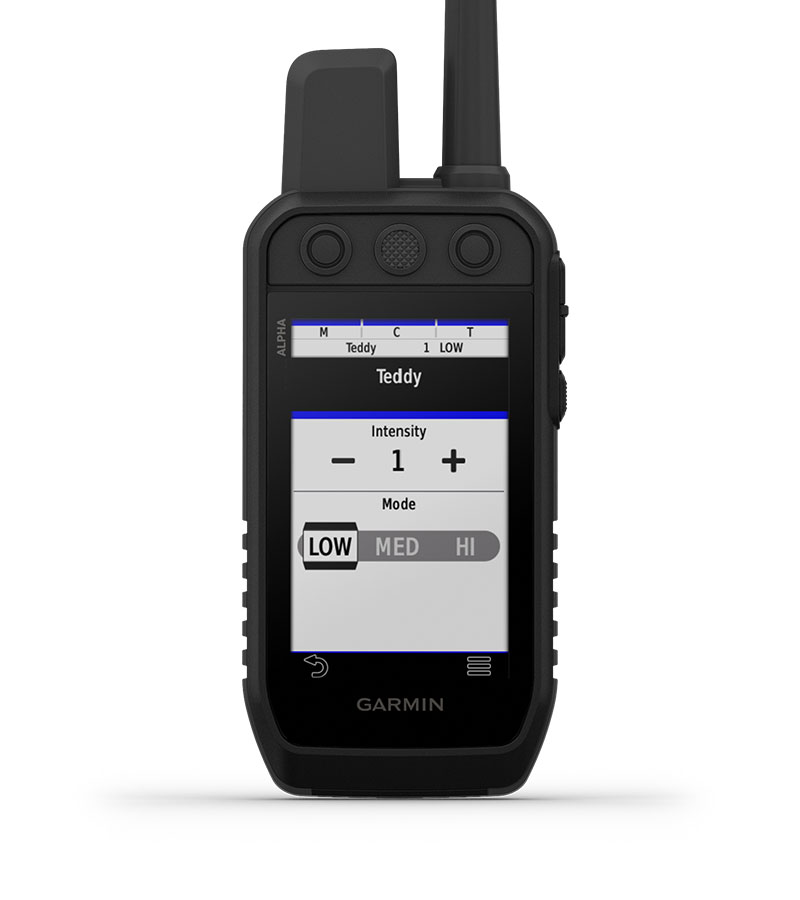
TRAIN YOUR PACKUse dedicated buttons for fast training cues and command initiation. Select from 18 levels of momentary and continuous stimulation. Hunters can also issue different levels of audible tone or vibration commands1. |
HUNT METRICSSee critical hunt metrics, such as distance, speed and time afield, right on the dog info screen1. |
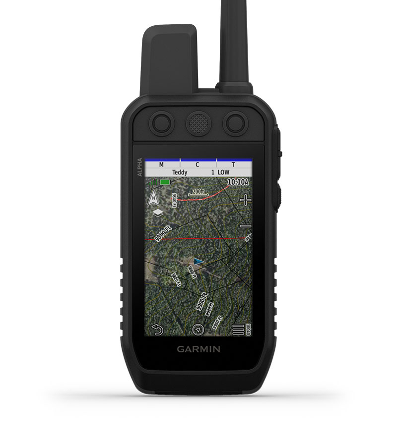
SATELLITE IMAGERYDownload satellite imagery via Wi-Fi® technology to your device, and see the terrain features from above to help you navigate or find suitable habitat for your quarry. |
HANDHELD FEATURES
|
|
|
|
|
| ||||


NAVIGATION FEATURES
|
|
|
|
|
|


General
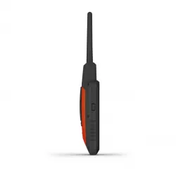
| DIMENSION | 2.7 x 6.4 x 1.3” (6.8 x 16.2 x 3.4 cm) *dimensions do not include antenna |
| WEIGHT | 9.9 oz (280 g) with standard antenna and battery |
| WATERPROOF | IPX7 |
| TOUCHSCREEN | |
| DISPLAY TYPE | transflective, color TFT touchscreen |
| DISPLAY SIZE | (WxH) 4.7 cm x 7.7 cm, 3.5" diag (88.9 mm) |
| DISPLAY RESOLUTION | 282 x 470 pixels |
| BATTERY TYPE | rechargeable lithium-ion (included) |
| BATTERY LIFE | up to 55 hours |
| MEMORY/HISTORY | 16 GB |
| INTERFACE | high-speed USB |
Maps & Memory
| PRELOADED MAPS | yes (TOPOActive) |
| ABILITY TO ADD MAPS | yes (see Additional) |
| AUTOMATIC ROUTING (TURN BY TURN ROUTING ON ROADS) FOR OUTDOOR ACTIVITIES | Yes (with optional mapping for detailed roads) |
| SATELLITE IMAGERY | yes (direct to device; no annual subscription required) |
| EXTERNAL MEMORY STORAGE | microSD card (not included) |
| WAYPOINTS/FAVORITES/LOCATIONS | 10,000 |
| TRACKS | up to 20 assets (any combination of compatible dog devices and handhelds) |
| NAVIGATION TRACK LOG | 20,000 points, 250 saved spx tracks, 300 saved fit activities |
| NAVIGATION ROUTES | 250 |
| STORED CONTACTS | 250 dogs |
| GROUP MANAGEMENT |
Sensors
| GPS | |
| GALILEO | |
| BAROMETRIC ALTIMETER | |
| COMPASS | Yes (tilt-compensated 3-axis) |
| HIGH-SENSITIVITY RECEIVER |
Outdoor Recreation
| SUN AND MOON INFORMATION | |
| CUSTOM MAPS COMPATIBLE |
Radio Features
| FREQUENCY BAND | MURS |
| CHANNELS | 5 |
| RANGE | 9 miles with compatible dog devices |
| LOCATION REPORTING (SEND AND RECEIVE GPS POSITIONS) | |
| VIBRATION ALERT | |
| CONTACTS |
Outdoor Applications
| COMPATIBLE WITH GARMIN EXPLORE™ APP | |
| GARMIN EXPLORE WEBSITE COMPATIBLE | |
| DOG TRACKING |
Connections
| CONNECTIONS WIRELESS CONNECTIVITY | yes (Wi-Fi®, BLE and ANT+®) |
Additional
| ADDITIONAL | Ability to add maps: yes (Outdoor Maps+) |
- Alpha 300 handheld with rechargeable lithium-ion battery pack
- Belt clip
- AC adapter
- Charging/data cable
- Documentation