
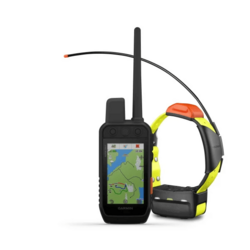


Alpha® 200i/T 5x Dog Tracking Bundle
Bundle (Includes T 5 Dog Device)
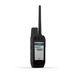
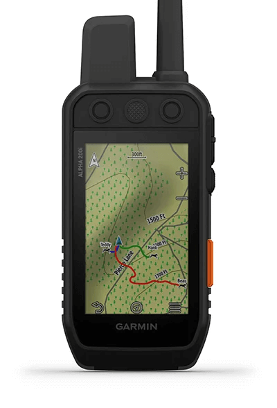
Handheld Only
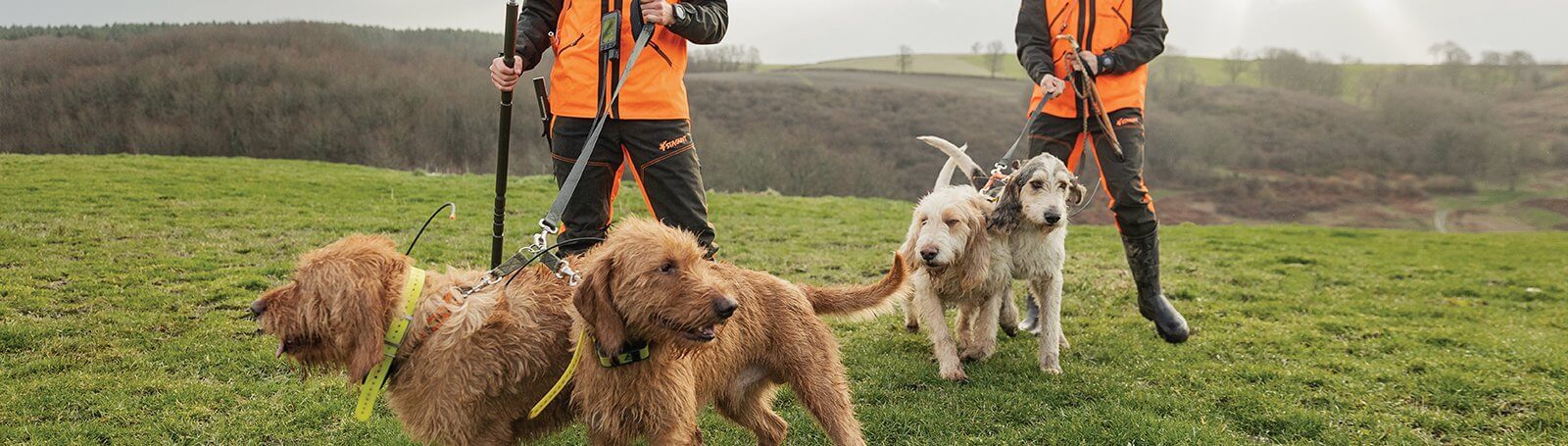
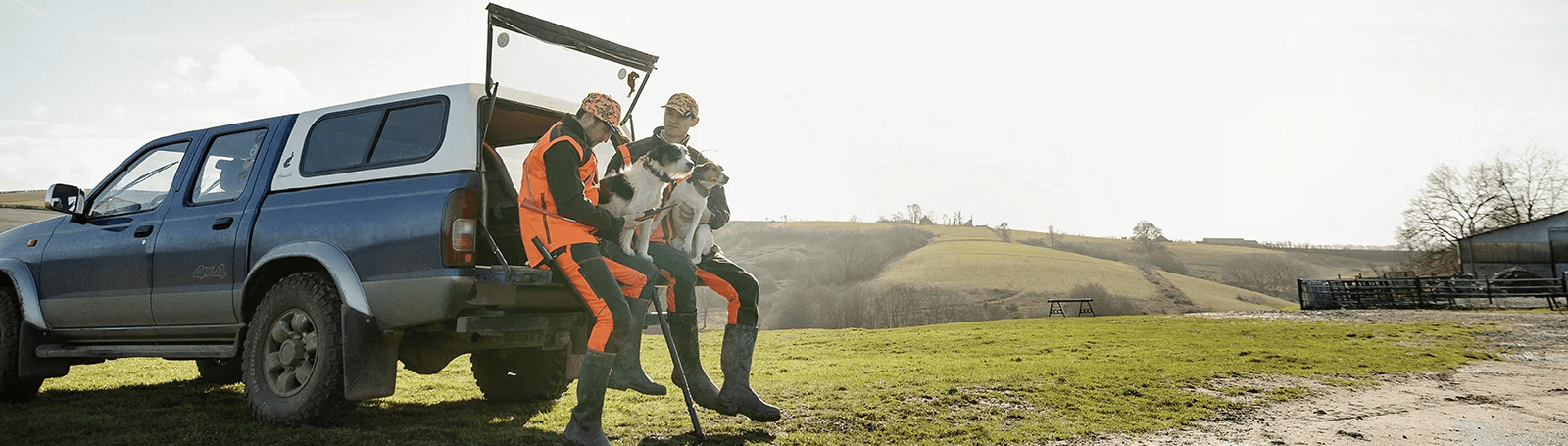
STRONG CONNECTION. STRONG BOND.
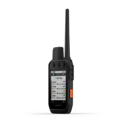
Track and train your dogs with the Alpha 200i system, featuring inReach® Iridium satellite technology, a sunlight-readable 3.5 inch capacitive touchscreen and user-friendly, six-button design.
Designed to make tracking and training simple, accessible and fast. | Track and train your pack while they're out in the field. | Keep inactive dogs in the system for easier setup and management. |
inReach technology helps you keep loved ones updated when mobiles can't (satellite subscription required). | Navigate every hunt with the best in Garmin mapping and sensors. | User-replaceable battery lasts up to 20 hours; up to 15 hours with inReach technology enabled. |
Take dog tracking
and training to the
next level.
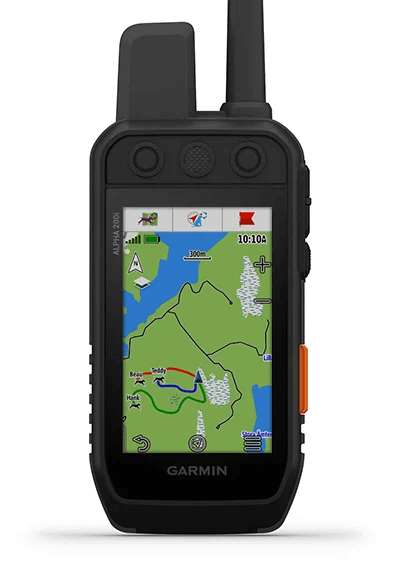
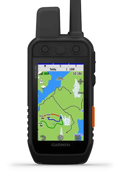
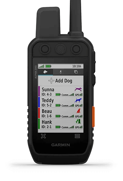
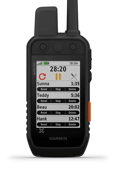
TRACK YOUR PACKMonitor up to 20 dogs from up to 14.5 kilometres (depending on dog device) with a 2.5-second update rate. Pair with T 5 or T 5 mini dog devices (sold separately or as a bundle). |
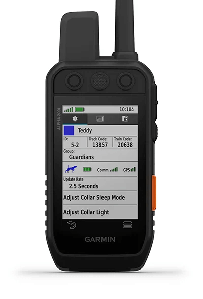
DOG LIST/GROUP MANAGEMENTKeep inactive dogs in your dog list, and manage active groups so you don't have to add and remove dogs for every hunt. Pair with T 5 or T 5 mini dog devices (sold separately or as a bundle). |
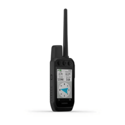
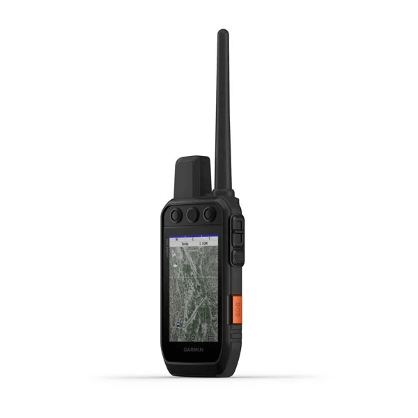
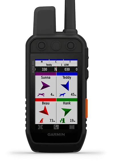
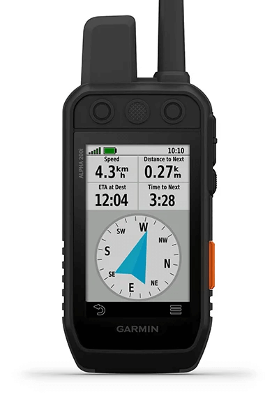
PRO VIEW COMPASSThe pro view compass mode gives you simple, at-a-glance tracking that shows which direction and how far away your dogs are, plus you will see when a dog is Treed or OnPoint. |

Navigate your
surroundings.
MULTI-GNSS SUPPORTAccess multiple global navigation satellite systems (GPS and Galileo) to track your pack with greater accuracy than GPS alone. |
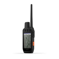
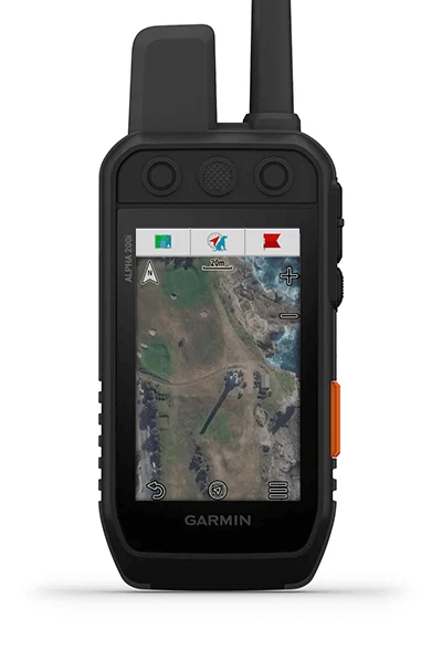
TOPOACTIVE EUROPE MAPSOur preloaded TopoActive Europe mapping provides detailed views of terrain contours, topographic elevations, summits, parks, coastlines, rivers, lakes and geographical points. |
BIRDSEYE SATELLITE IMAGERYDownload BirdsEye Satellite Imagery directly to the handheld for better-than-real-life views of your route, trailheads, clearings and more. |

NAVIGATION SENSORSA barometric altimeter helps you accurately monitor ascent and descent and see short-term trends in air pressure, and the built-in tilt-compensated three-axis electronic compass keeps your bearing — whether you're moving or not. |
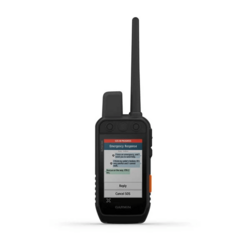
SEE IT ALLThe sunlight-readable 3.5 inch capacitive touchscreen display makes it easy to see and interact with your maps, dog data and more. |
STAY ON THE MOVEReplaceable battery lasts up to 20 hours, or up to 15 hours with inReach technology enabled. |
Stay in touch
using inReach
technology.
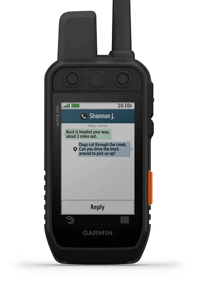
TWO-WAY MESSAGINGExchange text messages with loved ones, post to social media, or communicate inReach to inReach in the field (satellite subscription required). |
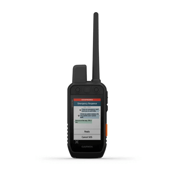
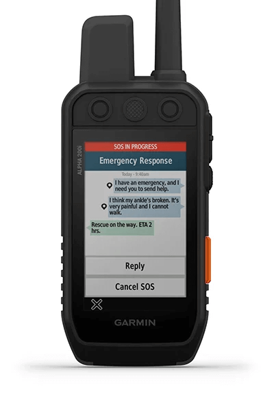
INTERACTIVE SOSIn case of emergency, trigger an interactive SOS message to GEOS, a professional 24/7 global monitoring and response centre (satellite subscription required). |
LOCATION SHARINGTrack your location, and share it with those at home or out in the field so they can see your progress or ping your device for your GPS location and more (satellite subscription required). |
General
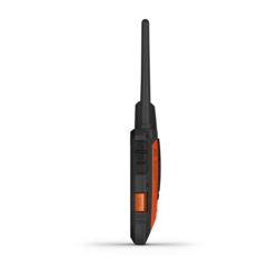
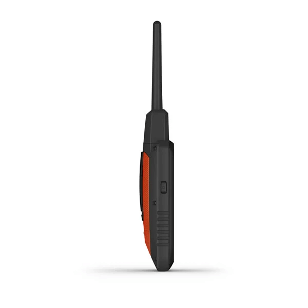
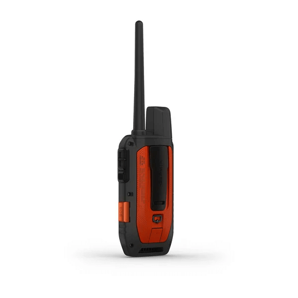
| PHYSICAL DIMENSIONS | 6.8 x 16.2 x 3.4 cm *dimensions do not include antenna |
| TOUCHSCREEN | |
| DISPLAY SIZE | 4.7 W x 7.7 H cm; 3.5 inch diag (88.9 mm) |
| DISPLAY RESOLUTION | 282 x 470 pixels |
| DISPLAY TYPE | Transflective, colour TFT touchscreen |
| WEIGHT | 280 g with standard antenna and battery |
| BATTERY TYPE | Rechargeable lithium-ion (included) |
| BATTERY LIFE | Up to 20 hours; up to 15 hours with inReach® technology enabled |
| WATER RATING | IPX7 |
| HIGH-SENSITIVITY RECEIVER | |
| INTERFACE | High-speed USB |
| MEMORY/HISTORY | 16 GB |
Maps & memory
| PRELOADED MAPS | Yes (TopoActive Europe) |
| ABILITY TO ADD MAPS | |
| BASEMAP | |
| AUTOMATIC ROUTING (TURN BY TURN ROUTING ON ROADS) | Yes (with optional mapping for detailed roads) |
| BIRDSEYE | Yes, direct to device (no annual subscription required) |
| STORAGE AND POWER CAPACITY | microSD™ card (not included) |
| WAYPOINTS/FAVOURITES/LOCATIONS | 10,000 |
| TRACKS | Up to 20 dogs (TT 15/TT 15 mini and T5/T 5 mini) and buddies (Alpha 100 and Alpha 200i) simultaneously |
| TRACK LOG | 20,000 points, 250 saved gpx tracks, 300 saved fit activities |
| ROUTES | 250 |
Sensors
| BAROMETRIC ALTIMETER | |
| COMPASS | Yes (tilt-compensated 3-axis) |
Safety and Tracking Features
| LIVETRACK | Yes (with Garmin Explore™) |
Outdoor Recreation
| SUN AND MOON INFORMATION | |
| CUSTOM MAPS COMPATIBLE |
inReach® features
| INTERACTIVE SOS | |
| SEND AND RECEIVE TEXT MESSAGES TO SMS AND EMAIL | |
| EXCHANGE LOCATIONS WITH OTHER INREACH DEVICE | |
| VIRTUAL KEYBOARD FOR CUSTOM MESSAGING | |
| SEND WAYPOINTS TO MAPSHARE DURING TRIP | |
| SEND ROUTE SELECTION TO MAPSHARE DURING TRIP |
Two-way Radio Features
| FREQUENCY BAND | VHF |
| RANGE | TT 15/T 5, 14.5 kilometres; TT 15 mini/T 5 mini, 6.5 kilometres |
Outdoor applications
| COMPATIBLE WITH GARMIN EXPLORE™ APP | |
| GARMIN EXPLORE WEBSITE COMPATIBLE |
Connections
| WIRELESS CONNECTIVITY | Yes (Wi-Fi®, Bluetooth® and ANT+®) |
- Alpha® 200i handheld with rechargeable lithium-ion battery pack
- T 5 dog device with rechargeable lithium-ion battery pack
- 2.5 cm orange collar strap
- Belt clip
- AC adapter
- Charge cable (for T 5)
- USB cables (micro and mini)
- Documentation