
GPSMAP® 79 Series


AMD162000
Marine Handheld With Worldwide Basemap
Description
TopoActive Mapping
BirdsEye Select 1:25k Bundle
inReach® Technology
Multi-Band Technology
CAST OFF CONFIDENTLY
Stay on course, and track more adventures with these rugged, floating handhelds.
It’s water-resistant, it floats, and it’s fogproof, so it belongs on the water — just like you. | This thing can remember up to 10,000 waypoints and more, so you don’t have to. | It’s nice to have reliable positioning when you’re out on the water. |
The built-in compass will point you in the right direction. | Get the best of Garmin and Navionics® data with optional BlueChart® g3 coastal charts. | Stay out longer with up to 19 hours of battery life in GPS mode. |

Built for life on the boat.
RUGGED HANDHELD
This handheld is water-resistant (IPX7) with a high-resolution color display you can read in the sun. The glass is even scratch-resistant and fogproof.
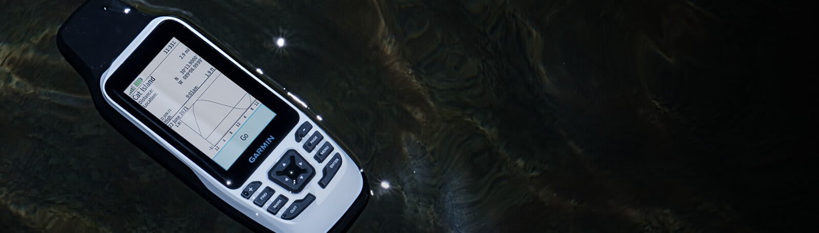
DESIGNED TO FLOAT
If rough waters come and the handheld goes overboard, don’t worry. This device floats.
BATTERY LIFE
User-replaceable AA batteries (not included) provide up to 19 hours of battery life in GPS tracking mode.
Exactly what you
need to navigate.
ACCURATE TRACKING
With support for multiple satellite constellations — such as GPS, GLONASS, Galileo, QZSS and SBAS — you’ll get accurate, reliable tracking and positioning around the world.

INCREASED MEMORY
More memory than previous models means you can save and track 10,000 waypoints, 250 routes and 300 fitness activity files.
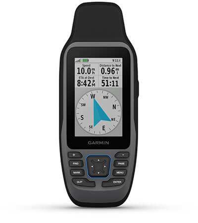
BUILT-IN COMPASS
The 3-axis tilt-compensated electronic compass shows your heading — even while the boat is standing still.
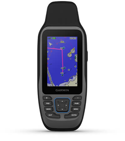
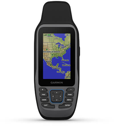
BLUECHART COVERAGE
Preloaded BlueChart g3 coastal charts (GPSMAP 79sc only) give you leading-edge coverage, clarity and detail with integrated Garmin and Navionics data. Coverage includes the U.S. and the Great Lakes.
General
| Lens Material | chemically strengthened glass |
| Dimension | 2.67” x 6.85” x 1.67” (6.77 x 17.40 x 4.23 cm) |
| Weight | 9.95 oz (282g) with batteries |
| Water rating | IPX7 |
| MIL-STD-810 | yes (thermal, shock, water); bare unit only |
| Display Type | transflective, 65K color TFT |
| Display Size | 1.5″W x 2.5″H (3.8 x 6.3 cm); 3″ diag (7.6 cm) |
| Display resolution | 240 x 400 pixels |
| Battery type | 2 AA batteries (not included); NiMH or Lithium recommended |
| Battery life | up to 19 hours |
| Memory/History | 8 GB (user space varies based on included mapping on sc version) |
| Interface | high speed microUSB and NMEA 0183 compatible |
Maps & memory
| Preloaded maps | Available on sc version only |
| Ability to add maps | |
| Basemap | |
| Automatic routing (turn by turn routing on roads) for outdoor activities | Yes (with optional mapping for detailed roads) |
| Map segments | 15000 |
| Includes detailed hydrographic features (coastlines, lake/river shorelines, wetlands and perennial and seasonal streams) | Yes (downloadable from Garmin Express™) |
| Includes searchable points of interests (parks, campgrounds, scenic lookouts and picnic sites) | Yes (downloadable from Garmin Express™) |
| Displays national, state and local parks, forests, and wilderness areas | Yes (downloadable from Garmin Express™) |
| External memory storage | yes (32 GB max microSD™ card, not included) |
| Waypoints/favorites/locations | 10,000 |
| Tracks | 250 |
| Navigation Track Log | 20,000 points, 250 saved gpx tracks, 300 saved fit activities |
| Navigation Routes | 250, 250 points per route; 50 points auto routing |
| Rinex logging |
Sensors
| GPS | |
| GLONASS | |
| QZSS | |
| SBAS | |
| COMPASS | Yes (tilt-compensated 3-axis) |
| HIGH – SENSITIVITY RECEIVER | |
| GPS COMPASS (WHILE MOVING) |
Daily smart features
| CONNECT IQ™ (DOWNLOADABLE WATCH FACES, DATA FIELDS, WIDGETS AND APPS) | |
| SMART NOTIFICATIONS ON HANDHELD | |
| VIRB® CAMERA REMOTE | |
| COMPATIBLE WITH GARMIN CONNECT™ MOBILE | |
| ACTIVE WEATHER |
Outdoor recreation
| Point-to-point navigation | |
| Area calculation | |
| Fish forecast | |
| Geocaching-friendly | Yes (Paperless) |
| Custom maps compatible | |
| Picture viewer |
- GPSMAP 79s or 79sc, depending on the version selected
- Lanyard
- USB cable
- Documentation
Additional information
| Shop by Series | GPSMAP |
|---|