


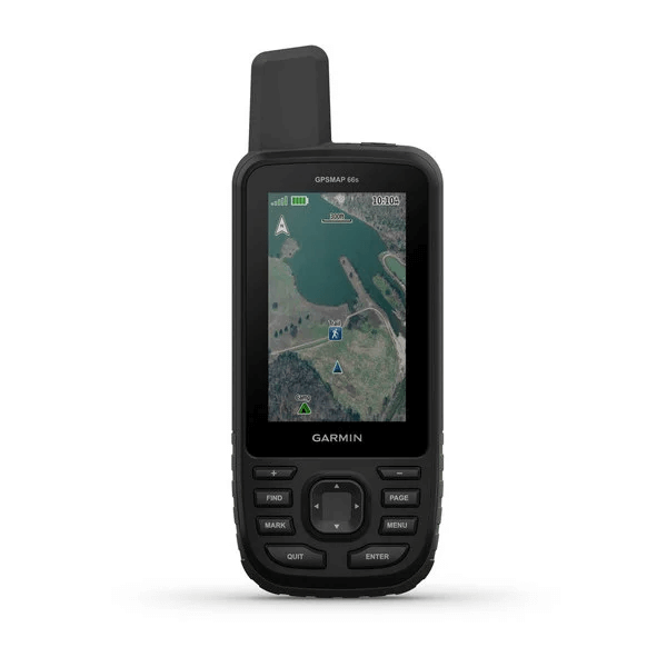
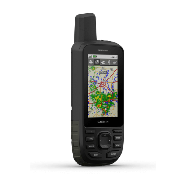
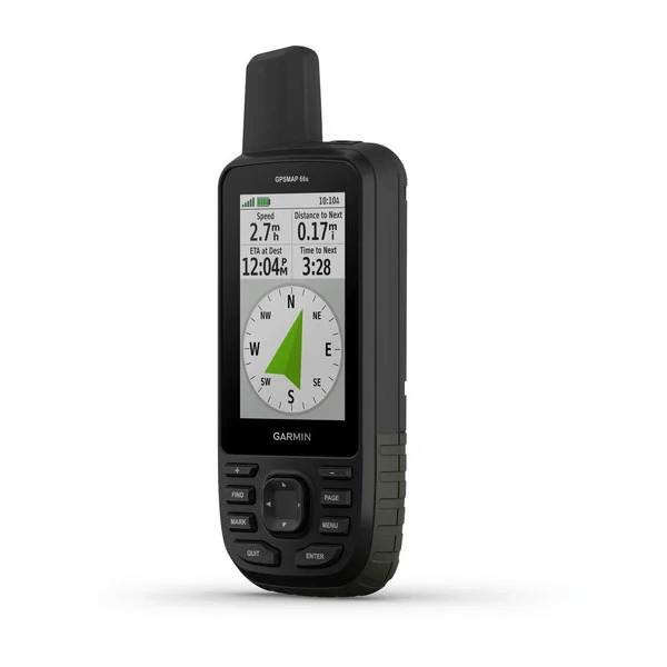
GPSMAP® 66s
GPSMAP 66s with BirdsEye Select Great Britain Plus
inReach® տեխնոլոգիա
NAVIGATE YOUR NEXT ADVENTURE
Whether you’re hiking, hunting, climbing, geocaching, kayaking or mountain biking, explore more by using this premium, rugged handheld with a 3-inch colour display.
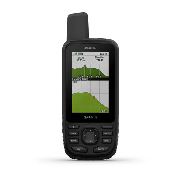
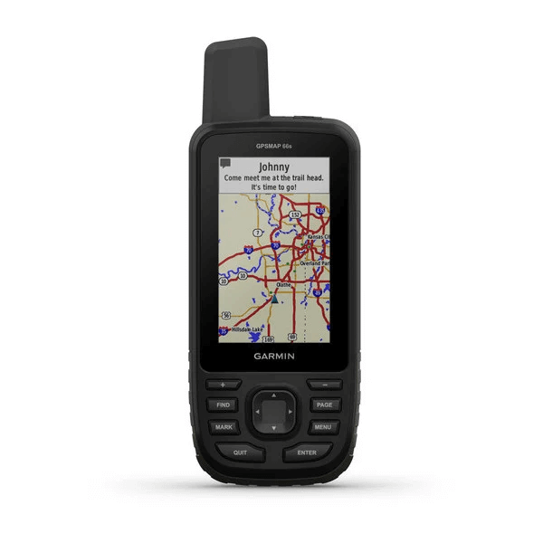
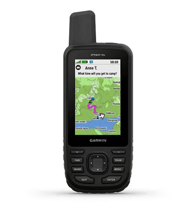
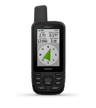
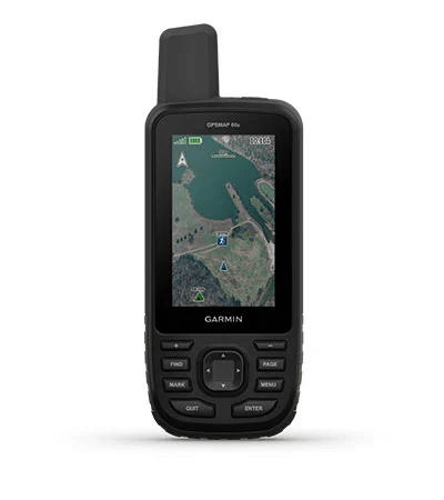
No matter the conditions, you’ll be able to see the large, sunlight-readable colour display. | Just GPS is great, but multi-GNSS satellite support and outdoor sensors are better. | Maps as pretty as a picture and just as detailed. |
See what’s coming with Active Weather, and never again be surprised by those clouds rolling in. | Open up a world of off-grid capabilities with the Garmin Explore™ website and app. | Go the distance with up to 16 hours of battery life in GPS mode and 1 week in expedition mode. |

Know the way.
MULTI-GNSS SUPPORTAccess multiple global navigation satellite systems (GPS, GLONASS and Galileo) to track in more challenging environments than GPS alone. |
ABC SENSORSNavigate every trail with ABC sensors, including an altimeter for elevation data, barometer to monitor weather and 3-axis electronic compass. |
BIRDSEYE SATELLITE IMAGERYDownload high-resolution photo-realistic maps directly to your device without an annual subscription. Easily find trails, pick stand locations, find parking, create waypoints and more. |

Be adventure
ready.
BUILT FOR ADVENTUREThis handheld is built to military standards for thermal, shock and water performance (MIL-STD-810), and it’s even compatible with night vision goggles. | LED FLASHLIGHTThe GPSMAP 66 series helps you keep gear to a minimum with a built-in LED flashlight that can be used as a beacon to signal for help. | GEOCACHINGGet automatic cache updates from Geocaching Live, including descriptions, logs and hints. When connected via Wi-Fi® technology or to the Garmin Connect™ app, each find will upload to your Geocaching.com profile. |
Գլխավոր
| Սարքի չափսը | 6.2 x 16.3 x 3.5 cm |
| Էկրանի չափսը | 3.8 x 6.3 cm; 3" diagonal |
| Էկրանի խտությունը | 240 x 400 pixels |
| Էկրանի տեսակը | Transflective colour TFT |
| Քաշը | 230g with batteries |
| Մարտկոցի տեսակը | 2 AA մարտկոցներ (ներառված չէ); նախընտրելի է NiMH կամ Լիթիումային |
| Մարտկոցի աշխատանքը | մինչև 16 ժամ մինչև 170 ժամ արշավախմբի ռեժիմում |
| Ջրակայունություն | IPX7 |
| MIL-STD-810 | այո (thermal, shock, water) |
| Բարձր զգայունության ընդունիչ | |
| Միացման տեսակը | high speed micro USB and NMEA 0183 compatible |
| Հիշողությունը | 16 ԳԲ |
Քարտեզներ և հիշողություն
| Ներառված քարտեզներ | Բազային քարտեզ միայն |
| Քարտեզներ ավելացնելու հնարավորություն | |
| Բազային քարտեզ | |
| Ավտոմատ երթուղի կազմում | Այո (with optional mapping for detailed roads) |
| Քարտեզի հատվածներ | 15000 |
| BIRDSEYE | այո (անմիջապես սարքին) |
| Ջրագրություն | |
| Հետաքրքրի կետերի որոնում | |
| Ազգային, պետական և տեղական զբոսայգիների, անտառների ու անապատային տարածքների ցուցադրում | |
| Հիշողության քարտի բնիկ | microSD™ card (չի ներառում) |
| Սեփական կետերի հիշողություն | 10,000 |
| Երթուղիների քանակ | 250 |
| Երթուղիների պահոց | 20,000 points, 250 saved gpx tracks, 300 saved fit activities |
| ROUTES | Routes: 250 |
| RINEX LOGGING |
Սենսորներ
| GPS | |
| GLONASS | |
| GALILEO | |
| Բարոմետրիկ բարձրաչափ | |
| Կողմնացույց | Այո (3 առանցքով) |
| GPS Կողմնացույց (միայն շարժման ժամանակ) |
Առօրյա սմարթ հատկություններ
| CONNECT IQ™ (ներբեռնվող ժամացույցի էկրաններ, ծանուցումներ, ծրագրեր) | |
| Խելացի հնարավորություններ | |
| VIRB® տեսախցիկի հեռահար կառավարում | |
| Համատեղելի է GARMIN CONNECT™ մոբայլի հետ | |
| Ակտիվ եղանակ |
Անվտանգության հնարավորություններ
| LIVETRACK |
Դրսի մարզման առանձնահատկություններ
| Կետից կետ ուղղորդում | |
| Համատեղելի է BASECAMP™ հետ | |
| Մակերեսի հաշվարկ | |
| Ձկնորսի/որսորդի օրացույց | |
| Արևի/լուսնի օրացույց | |
| XERO™ | |
| GEOCACHING-FRIENDLY | այո (Geocache Live) |
| Անհատական քարտեզների համատեղելիություն | այո (500 հատ) |
| Նկարների դիտում | |
| Տեսախցիկ | Ոչ |
| INREACH REMOTE WIDGET | |
| LED BEACON FLASHLIGHT |
Բացօթյա ծրագրեր
| Համատեղելիություն GARMIN EXPLORE™ ծրագրի հետ | |
| Համատեղելիություն GARMIN EXPLORE կայքի հետ |
Կապեր
| Անլար համակցում | այո (Wi-Fi®, BLUETOOTH®, ANT+®) |
Հավելյալ
| Հավելյալ |
|
- GPSMAP 66s
- Access to Birdseye satellite imagery
- USB լար
- Carabiner clip
- Փաստաթղթեր
GPSMAP 66s with BirdsEye Select Great Britain Plus
- GPSMAP 66s
- Access to Birdseye satellite imagery
- BirdsEye Select Great Britain Plus Download Voucher
- USB լար
- Carabiner clip
- Փաստաթղթեր