

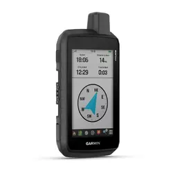


Montana® 710
Rugged GPS Touchscreen Handheld
inReach® տեխնոլոգիա
8 MP տեսախցիկ
Montana® 710/760


STAY ON TRACK THROUGH ALL KINDS OF ADVENTURES
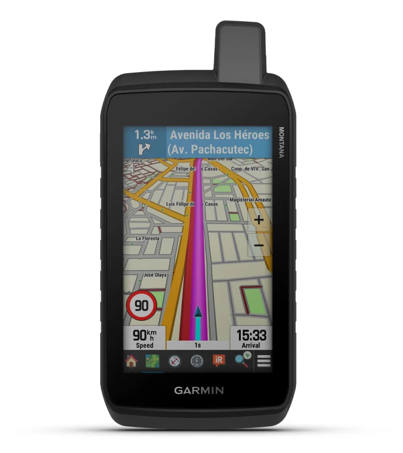
With routable mapping for roads and trails, the Montana 710 handheld brings advanced outdoor features into a sturdy 5-inch format that’s ideal for navigation on foot, bike, kayak, ATV and more.
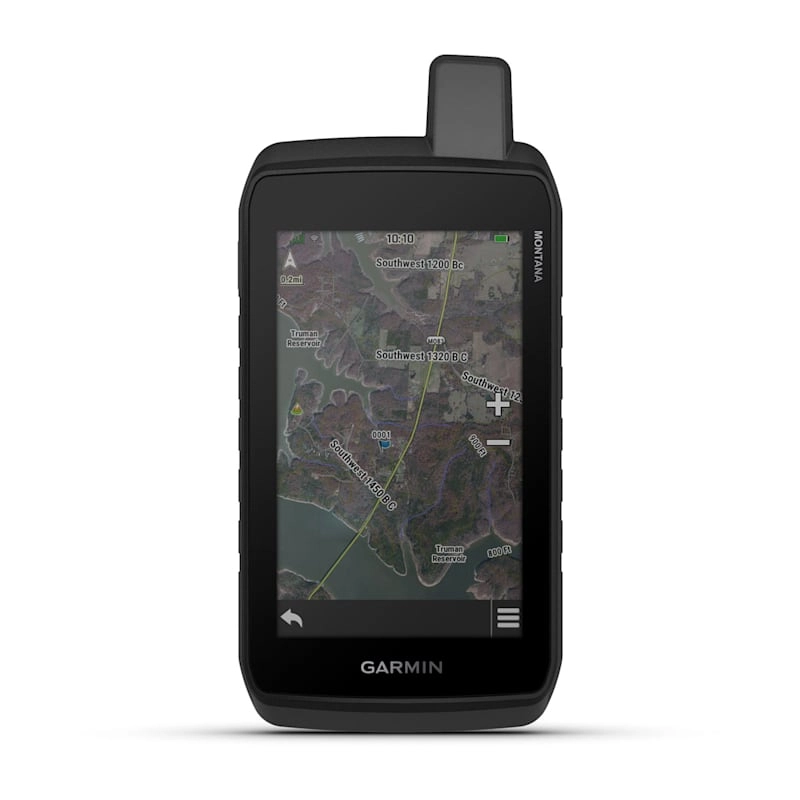
LARGE 5-INCH GLOVE-FRIENDLY TOUCHSCREEN | PRELOADED ROUTABLE TOPOGRAPHIC MAPS WITH LANDMARKS |
MEETS MIL-STD 810 FOR THERMAL, SHOCK, WATER AND VIBRATION |
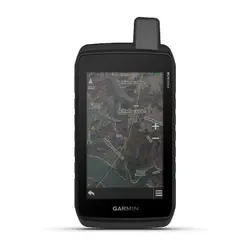
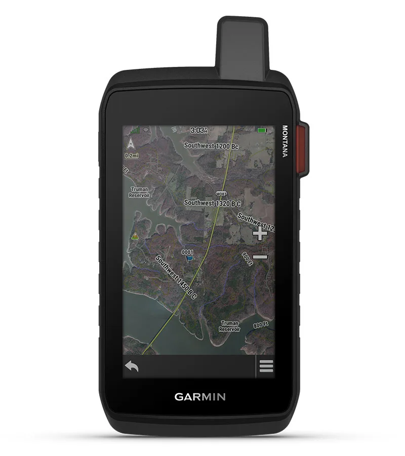
SATELLITE IMAGERY SHOWS VIVID OVERHEAD VIEWS OF YOUR ROUTE |
SUPPORTS OUTDOOR MAPS+ FOR PREMIUM MAPPING (SOLD SEPARATELY) |
PLAN AND REVIEW TRIPS WITH THE GARMIN EXPLORE™ SMARTPHONE APP |

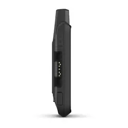
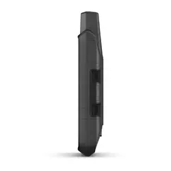
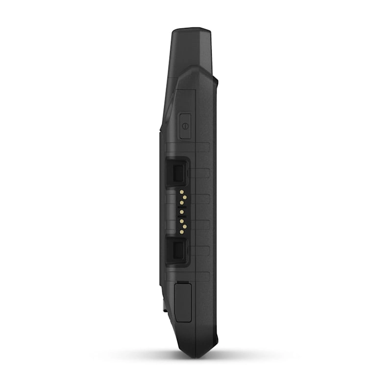
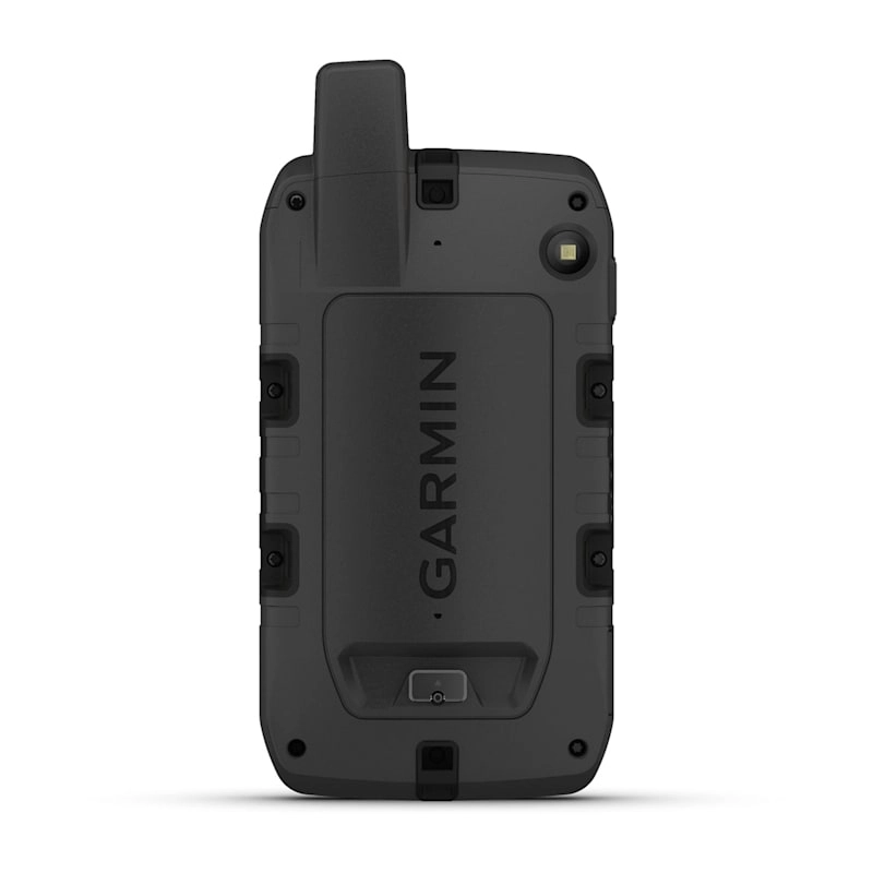
 RUGGED BY DESIGNThis durable, water-resistant handheld is tested to meet MIL-STD 810 for thermal, shock, water and vibration. It features a glove-friendly 5-inch touchscreen and is compatible with a variety of robust mounting solutions (sold separately) to best suit your activities․ |
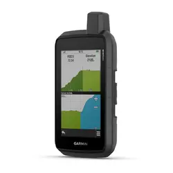
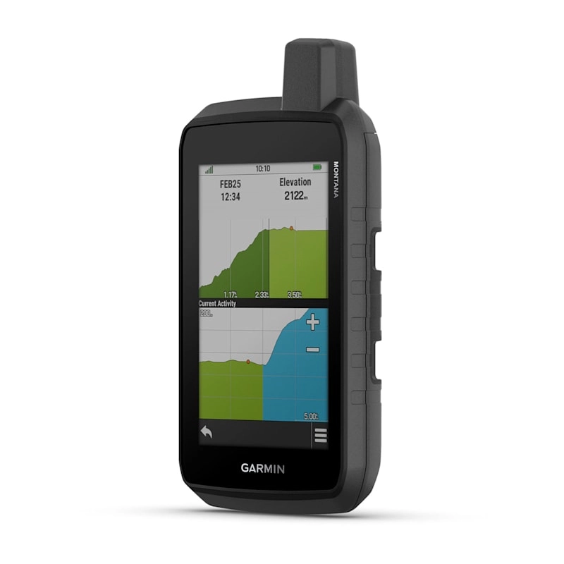
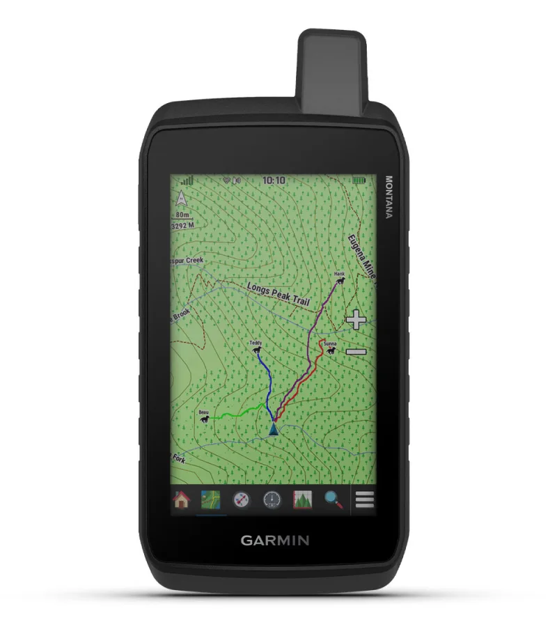
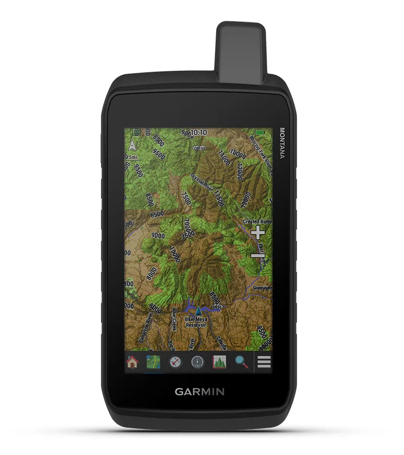 TOPOACTIVE MAPSTo navigate your adventures, use preloaded topographical maps. View terrain contours, elevations, coastlines, rivers, landmarks and more. |
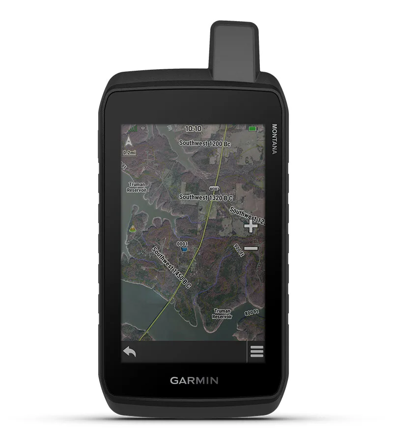 SATELLITE VIEWSAccess subscription-free, high-resolution satellite imagery with direct-to-device downloads over Wi-Fi® connectivity. See photorealistic overhead views of routes and surrounding terrain, and easily create waypoints based on landmarks. |
 ADDITIONAL MAPSWith 32 GB of onboard memory, you can download even more maps, such as City Navigator® maps for your drive or BlueChart® g3 charts for the water (sold separately). |
 OUTDOOR MAPS+Add a subscription to Outdoor Maps+ (sold separately), and get ongoing access to a wide variety of premium mapping content and regular updates sent right to your Garmin device via Wi-Fi technology. |
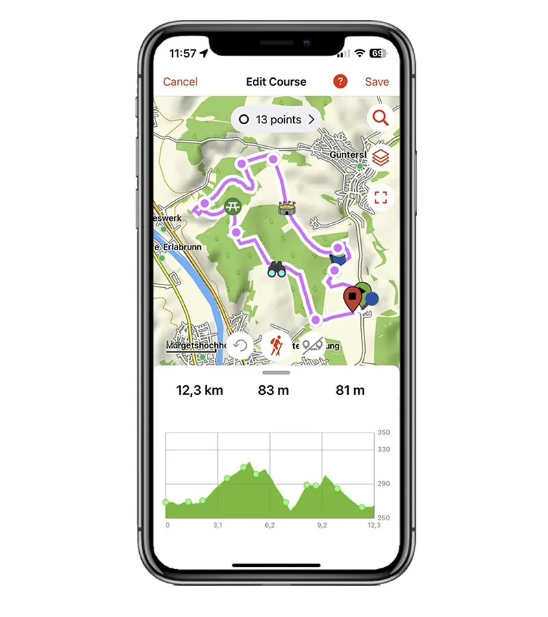 GARMIN EXPLORE™ APPPair with the Garmin Explore app to plan and review trip data, plus manage your waypoints, courses and activities. |

NAVIGATION FEATURES
MULTI-GNSS SUPPORTAccess to GPS and Galileo satellite networks enables Montana 710 to track in more challenging environments than GPS alone. |
ABC SENSORSNavigate your next trail with ABC sensors, including an altimeter for elevation data, barometer to monitor weather and 3-axis electronic compass. |
ACTIVE WEATHERAccess up-to-date active weather forecasts via the Garmin Connect™ app on your compatible smartphone |
DOG TRACKINGFor hunters and trainers, this Montana handheld syncs with your compatible Astro® or Alpha® series handhelds to help track sporting dogs in the field. |
WIKILOC TRAILSThis preloaded app lets you easily download hiking, cycling and other Wikiloc trails shared by outdoor enthusiasts like you. Get a free 60-day Wikiloc Premium trial to try this and other exclusive features. Learn more. |
ADVENTURE FEATURES
EXPEDITION MODETrek far and wide off-grid. Use expedition mode, an ultralow-powered GPS reference, to keep Montana tracking for more than 2 weeks between recharges. |
BATTERY OPTIONSAn internal lithium-ion battery pack provides up to 24 hours of battery life in GPS mode and recharges with a standard USB-C® cable. |
VEHICLE MOUNTSA variety of Montana handheld-compatible mounts (sold separately) lets you adapt your navigator for use on ATVs, boats, cars, motorcycles, RVs or other vehicles. |
General
| Lens Material | chemically strengthened glass |
| Dimension | 8.76 x 18.30 x 3.27 cm (3.5″ x 7.2″ x 1.3″) |
| Weight | 410g (14.5oz) with included lithium-ion battery pack |
| Water rating | IPX7 |
| MIL-STD-810 | yes (thermal, shock, water, vibe) |
| Touchscreen | ✔ |
| Display Type | WVGA transflective, dual orientation |
| Display Size | 6.48 x 10.80 cm (2.55″W x 4.25″H); 12.70 cm (5″ diag) |
| Display resolution | 480 x 800 pixels |
| Battery Type | rechargeable lithium-ion (included) |
| Battery life | GPS Mode: up to 24 hours Note – Battery life estimates are with full sky view and can be significantly impacted by obstructions or tree cover |
| Memory/History | 32 GB (user space varies based on included mapping) |
| Interface | high-speed micro USB-C |
Maps & memory
| Preloaded maps | yes (TopoActive, by region; North America) |
| Ability to add maps | ✔ |
| Basemap | ✔ |
| Automatic routing (turn by turn routing on roads) for outdoor activities | ✔ |
| Map segments | 15,000 |
| Satellite Imagery | yes (direct to device) |
| Includes detailed hydrographic features (coastlines, lake/river shorelines, wetlands and perennial and seasonal streams) | ✔ |
| Includes searchable points of interests (parks, campgrounds, scenic lookouts and picnic sites) | ✔ |
| Displays national, state and local parks, forests, and wilderness areas | ✔ |
| External memory storage | yes (32 GB max microSD™ card) |
| Waypoints/favorites/locations | 10,000 |
| Courses | 250, 200 course points per course |
| Tracks | 250 |
| Navigation Track Log | 20,000 points, 250 saved gpx tracks, 300 saved fit activities |
| Navigation Routes | 250, 250 points per route; 50 points auto routing |
| Rinex logging | ✔ |
Sensors
| GPS | ✔ |
| GALILEO | ✔ |
| Barometric altimeter | ✔ |
| Compass | Yes (tilt-compensated 3-axis) |
| High-sensitivity receiver | ✔ |
| GPS compass (while moving) | ✔ |
Daily Smart Features
| Connect IQ™ (downloadable watch faces, data fields and apps) | ✔ |
| Smart notifications on handheld | ✔ |
| Weather forecasts | ✔ |
| Weather | ✔ |
| Compatible with Garmin Messenger app | ✔ |
| VIRB® Remote | ✔ |
| Pairs with Garmin Connect™ Mobile | ✔ |
Safety and Tracking Features
| LiveTrack | ✔ |
Tactical Features
| XERO™ Locations | ✔ |
Outdoor Recreation
| Point-to-point navigation | ✔ |
| TracBack® | ✔ |
| Area calculation | ✔ |
| Fish forecast | ✔ |
| Sun and moon information | ✔ |
| Geocaching-friendly | yes (Geocache Live) |
| Custom maps compatible | yes (500 custom map tiles) |
| Picture viewer | ✔ |
| LED beacon flashlight | ✔ |
inReach® Features
| inReach remote compatible | ✔ |
Outdoor Applications
| Compatible with Garmin Explore™ app | ✔ |
| Garmin Explore website compatible | ✔ |
| Dog tracking | yes (when paired to compatible dog track system) |
Connections
| Connections Wireless Connectivity | Yes (Wi-Fi®, BLUETOOTH®, ANT+®) |
- Montana® 710
- High capacity lithium-ion battery pack
- USB cable
- Documentation