
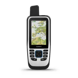


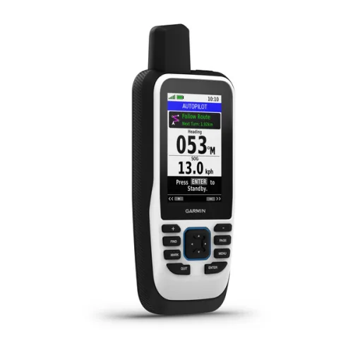

GPSMAP® 86s
Ծովային, նախաբեռնված համաշխարհային բազային քարտեզով
inReach® տեխնոլոգիա
CAST OFF CONFIDENTLY WITH A PREMIUM MARINE HANDHELD GPS
Stay on course with the GPSMAP 86s handheld. It provides all the outdoor functions of the GPSMAP® 66 series and adds on-the-water features — including wireless connectivity to your onboard marine system.
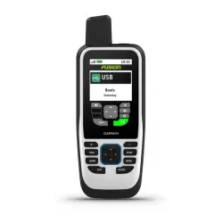
It’s water resistant, and it floats, so it’s as at home on the water as you. | See all your marine system info at a glance with boat data streaming. | Put convenient control of your autopilot and Fusion® systems at your fingertips. |
Add BlueChart® g3 coastal charts for enhanced fishing and navigation. | Get smart notifications so you can stow your phone. | Stay out longer with up to 40 hours of battery life in standard mode. |

Set your course.
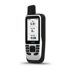
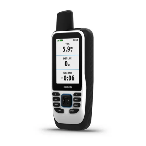
BOAT DATASync with compatible Garmin chartplotters and instruments to see real-time boat data displayed right on your GPS handheld device. |
FUSION-LINK AUDIOGet convenient remote operation of selected onboard Fusion marine products. |
ACCURATE TRACKINGWhen you’re underway, an adjustable GPS filter smooths speed and heading indications as you pass over swells for more accurate tracking. |


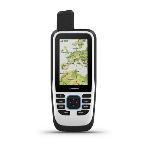
WORLDWIDE BASEMAPSee worldwide shaded relief coverage, including oceans, seas, major lakes and rivers. And see international and state political boundaries and time zone information. |
BLUECHART COVERAGEOptional BlueChart g3 coastal charts give you leading-edge coverage, clarity and detail with integrated Garmin and Navionics data. |
AUTOPILOT REMOTEEven when you’re not at the helm, you can control your boat. Access the autopilot app to change heading, engage pattern steering and follow a GPS route. |


Stay connected.
SMART NOTIFICATIONSGet smart notifications right on your GPSMAP 86s handheld when you pair it with your compatible smartphone. | GARMIN EXPLORE™ APPSync GPSMAP 86s handheld with Garmin Explore for cloud management of your favorite waypoints, tracks and routes. | WIRELESS CONNECTIONSGPSMAP 86s handheld offers Wi-Fi® connectivity, ANT+® technology and Bluetooth® wireless technology for easy wireless updates and connections. |
General
| Lens material | chemically strengthened glass |
| Dimension | WxHxD: 6.75 x 17.8 x 4.4 cm |
| Weight | 272 g |
| Water rating | IPX7 |
| MIL-STD-810 | yes (thermal, shock, water) |
| Display Type | Transflective, 65K colour TFT |
| Display Size | 3.8 x 6.3 cm; 3" diag (7.6 cm) |
| Display Resolution | 240 x 400 pixels |
| Battery type | Rechargeable internal lithium ion |
| Battery life | Up to 40 hours in 10-minute tracking mode; up to 200 hours (expedition mode) |
| Memory/history | 16 GB |
| Interface | high speed microUSB and NMEA 0183 compatible |
Maps & memory
| Ability to add maps | |
| Basemap | |
| Map segments | 15000 |
| Satellite Imagery | yes (direct to device) |
| Includes searchable points of interests (parks, campgrounds, scenic lookouts and picnic sites) | Yes (downloadable from Garmin Express™) |
| Displays national, state and local parks, forests, and wilderness areas | Yes (downloadable from Garmin Express™) |
| Storage and Power Capacity | microSD™ card (not included) |
| Waypoints/favourites/locations | 10000 |
| Tracks | 250 |
| Navigation Track Log | 20,000 points, 250 saved gpx tracks, 300 saved fit activities |
| Navigation Routes | 250 |
| Rinex logging |
Sensors
| GPS | |
| GLONASS | |
| GALILEO | |
| BAROMETRIC ALTIMETER | |
| COMPASS | Yes (tilt-compensated 3-axis) |
| High-sensitivity receiver | |
| GPS compass (while moving) |
Daily smart features
| Connect IQ™ (downloadable watch faces, data fields, widgets and apps) | |
| Smart notifications on handheld | |
| Weather forecasts | |
| Active Weather | |
| VIRB® camera remote | |
| Compatible with Garmin Connect™ Mobile |
Safety and Tracking Features
| LiveTrack |
Tactical features
| XERO™ Locations |
Outdoor recreation
| Point-to-point navigation | |
| Area calculation | |
| Fish forecast | |
| Sun and moon information | |
| Geocaching-friendly | Yes (Geocache Live) |
| Custom maps compatible | Yes (500 custom map tiles) |
| Picture viewer | |
| LED beacon flashlight |
Outdoor applications
| Compatible with Garmin Explore™ app | |
| Garmin Explore website compatible |
inReach® features
| inReach remote compatible |
Connections
| WIRELESS CONNECTIVITY | yes (Wi-Fi®, BLUETOOTH®, ANT+®) |
Security Information
| Security updates until at least (YYYY-MM-DD) | 2021-09-04 |
- GPSMAP® 86s handheld with worldwide basemap
- Lanyard
- USB to Micro USB cable
- Documentation